1
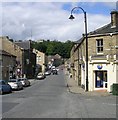
Britannia Road, Slaithwaite
Now that's what I call a chimney. Stone with an octagonal barrel showing a pronounced batter and with an ornate oversailer and cap arrangement. The satellite image shows that it's still there. To the right you can just see the top of the strange misshape of a chimney on Globe Mills.
Image: © Chris Allen
Taken: 29 Apr 1990
0.02 miles
2
Kitchen Fold, Slaithwaite
Kitchen Fold is a minor road in the village of Slaithwaite, in West Yorkshire.
Image: © Malc McDonald
Taken: 13 Jun 2021
0.02 miles
3
Huddersfield Narrow Canal, Slaithwaite
The section of canal through Slaithwaite town centre, between locks 21E and 23E had been culverted, and a car park covered part of the route.
Restoration caused some local controversy, as it involved the felling of a row of mature cherry trees which had been planted along the in filled line, although the local authority claimed that the trees were in poor condition, and unlikely to last for many more years in any case.
Lock 21E was relocated a short distance upstream, to the other side of Platt Lane, in order to ensure that the Platt Lane crossing could be achieved by a conventional bridge instead of the swing bridge that had existed prior to closure.
Image: © Rude Health
Taken: 24 Nov 2014
0.03 miles
4
River Colne - viewed from Britannia Road, Slaithwaite
Image: © Betty Longbottom
Taken: 8 Aug 2008
0.03 miles
5
Bridge Street, Slaithwaite
The mill is Globe Mill
Image: © Stanley Walker
Taken: 10 Jul 2008
0.03 miles
6
Britannia Road - Slaithwaite
Image: © Betty Longbottom
Taken: 8 Aug 2008
0.04 miles
7
Bradley Brook, Slaithwaite
Bradley Brook is a stream which flows down the hillside into Slaithwaite, where it flows into the River Colne.
Image: © Malc McDonald
Taken: 13 Jun 2021
0.04 miles
8
Slaithwaite Library - Britannia Road
Image: © Betty Longbottom
Taken: 8 Aug 2008
0.04 miles
9
The Star Inn, Manchester Road, Slaithwaite
Image: © Pamela Norrington
Taken: 6 Jan 2010
0.05 miles
10
Bus stop and shelter on Manchester Road (A62), Slaithwaite
Looking north east.
Image: © JThomas
Taken: 8 Nov 2018
0.05 miles


