IMAGES TAKEN NEAR TO
Banks Road, HUDDERSFIELD, HD7 5FP
Introduction
This page details the photographs taken nearby to Banks Road, HD7 5FP by members of the Geograph project.
The Geograph project started in 2005 with the aim of publishing, organising and preserving representative images for every square kilometre of Great Britain, Ireland and the Isle of Man.

There are currently over 7.5m images from over14,400 individuals and you can help contribute to the project by visiting https://www.geograph.org.uk
Image Map
Images are licensed for reuse under creativecommons.org/licenses/by-sa/2.0
Notes
- Clicking on the map will re-center to the selected point.
- The higher the marker number, the further away the image location is from the centre of the postcode.
Image Listing (50 Images Found)
Images are licensed for reuse under creativecommons.org/licenses/by-sa/2.0
Image
Details
Distance
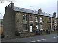
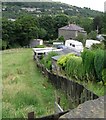
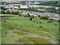
3
Housing at Slaithwaite.
Colne valley.
Image: © steven ruffles
Taken: 8 Jul 2023
0.06 miles
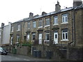
4
Footpath - Manchester Road, Linthwaite
Image: © Betty Longbottom
Taken: 8 Aug 2008
0.07 miles
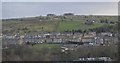
5
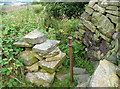
Stile on the Colne Valley Circular Walk
The path is hemmed-in by brambles and nettles, which seem to occur often on the approach to stiles.
Image: © Humphrey Bolton
Taken: 27 Aug 2013
0.09 miles
6
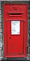
Victorian postbox on Manchester Road (A62), Slaithwaite
Postbox No. HD7 309.
Image: © JThomas
Taken: 8 Nov 2018
0.09 miles
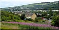
7
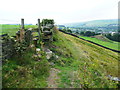
Stile on the Colne Valley Circular Walk
The path keeps to the top of the steep slope, next to the wall, and then crosses the wall via this stile. There is a quarry spoil heap in the next field on the right.
Image: © Humphrey Bolton
Taken: 27 Aug 2013
0.09 miles
9
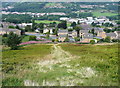
Line of former wall
I thought that this was an unofficial path, or a track made by sledging when the ground is snow-covered, but then I realised that it coincides with a wall shown on old maps. The soil conditions must be different along the line of the wall so that the vegetation is grass rather than bilberries.
Image: © Humphrey Bolton
Taken: 27 Aug 2013
0.10 miles