IMAGES TAKEN NEAR TO
Ryefield Road, HUDDERSFIELD, HD7 4DB
Introduction
This page details the photographs taken nearby to Ryefield Road, HD7 4DB by members of the Geograph project.
The Geograph project started in 2005 with the aim of publishing, organising and preserving representative images for every square kilometre of Great Britain, Ireland and the Isle of Man.

There are currently over 7.5m images from over14,400 individuals and you can help contribute to the project by visiting https://www.geograph.org.uk
Image Map
Images are licensed for reuse under creativecommons.org/licenses/by-sa/2.0
Notes
- Clicking on the map will re-center to the selected point.
- The higher the marker number, the further away the image location is from the centre of the postcode.
Image Listing (91 Images Found)
Images are licensed for reuse under creativecommons.org/licenses/by-sa/2.0
Image
Details
Distance
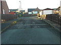
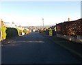
2
Ryefields Road - viewed from Edge View
Image: © Betty Longbottom
Taken: 29 Dec 2015
0.04 miles
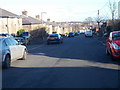
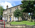
3
Arthur Street - Knowl Road, Golcar
Image: © Betty Longbottom
Taken: 13 Aug 2008
0.04 miles
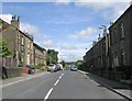
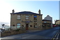
7
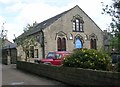
Providence Methodist School - Knowl Road, Golcar
Built 1878 - now converted into Knowle Court Residential Home.
Image: © Betty Longbottom
Taken: 13 Aug 2008
0.07 miles
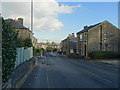
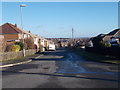
10
Junction One, Cafe Bar, Golcar
Junction of Knowl Road, James Street.
Image: © JThomas
Taken: 2 Nov 2018
0.07 miles