IMAGES TAKEN NEAR TO
Coal Pit Lane, BRIGHOUSE, HD6 4HW
Introduction
This page details the photographs taken nearby to Coal Pit Lane, HD6 4HW by members of the Geograph project.
The Geograph project started in 2005 with the aim of publishing, organising and preserving representative images for every square kilometre of Great Britain, Ireland and the Isle of Man.

There are currently over 7.5m images from over14,400 individuals and you can help contribute to the project by visiting https://www.geograph.org.uk
Image Map
Images are licensed for reuse under creativecommons.org/licenses/by-sa/2.0
Notes
- Clicking on the map will re-center to the selected point.
- The higher the marker number, the further away the image location is from the centre of the postcode.
Image Listing (102 Images Found)
Images are licensed for reuse under creativecommons.org/licenses/by-sa/2.0
Image
Details
Distance
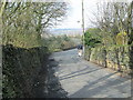
1
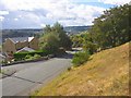
New Street, Clifton
This street runs parallel to Towngate. This is the eastern end, where it meets Grange Lane.
Image: © Humphrey Bolton
Taken: 28 Aug 2006
0.03 miles
2
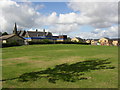
Recreation ground, church and school
In the background, St John's Church was completed in 1859; at first it was a chapel dependent on Hartshead Church. Stone came from the Blakelaw quarry nearby. The church school was built in 1872, and is behind the modern extension with the blue barge-boards.
Image: © Humphrey Bolton
Taken: 28 Aug 2006
0.03 miles
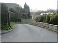
5
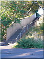
Steps on Brighouse FP81 at New Street, Clifton
This path does not appear on OS maps until the mid-20C. It runs between the village school and a recreation ground.
Image: © Humphrey Bolton
Taken: 1 Oct 2015
0.05 miles
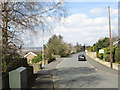
8

Recreation ground, Clifton
The recreation ground is seen from Grange Lane. St. John's Church of England Primary Academy Clifton can be seen behind ground.
Image: © habiloid
Taken: 4 Apr 2020
0.08 miles
9
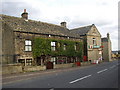
Sundial Cottage, Towngate, Clifton
It is inscribed 'I have the time' and the date 1783. It is said to have been transferred from another building in the village, now demolished. The post office is in a former Co-op shop, dated 1882 and with the beehive emblem.
Image: © Humphrey Bolton
Taken: 26 Sep 2005
0.09 miles
10
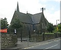
St John's Church - Towngate, Clifton
Image: © Betty Longbottom
Taken: 14 May 2008
0.09 miles