IMAGES TAKEN NEAR TO
Prospect Way, BRIGHOUSE, HD6 4FF
Introduction
This page details the photographs taken nearby to Prospect Way, HD6 4FF by members of the Geograph project.
The Geograph project started in 2005 with the aim of publishing, organising and preserving representative images for every square kilometre of Great Britain, Ireland and the Isle of Man.

There are currently over 7.5m images from over14,400 individuals and you can help contribute to the project by visiting https://www.geograph.org.uk
Image Map
Images are licensed for reuse under creativecommons.org/licenses/by-sa/2.0
Notes
- Clicking on the map will re-center to the selected point.
- The higher the marker number, the further away the image location is from the centre of the postcode.
Image Listing (138 Images Found)
Images are licensed for reuse under creativecommons.org/licenses/by-sa/2.0
Image
Details
Distance
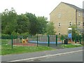
1
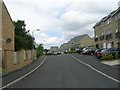
Prospect Way - viewed from Beechwood Park
Image: © Betty Longbottom
Taken: 4 Jul 2009
0.03 miles
5
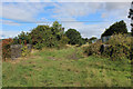
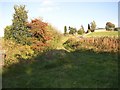
Disused Bailiffe Bridge Branch Line
Trackbed of the short lived Bailiff(e) Bridge Branch Line
Image: © Chris Heaton
Taken: 29 Aug 2018
0.05 miles
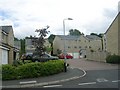
7
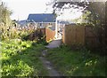
Footpath into new housing estate, Birkhouse, Clifton
This footpath used to go from Low Lane, Birkhouse, down through fields to Clifton Beck. It has now been absorbed into a new housing estate, but at least it hasn't been closed.
Image: © Humphrey Bolton
Taken: 9 Oct 2006
0.06 miles
8
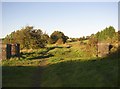
Disused railway line, Birkhouse, Clifton
This was the Bailiff Bridge branch line. The stone structures are the parapets of a very narrow bridge over a track, now overgrown as people walk over the railway embankment instead.
Image: © Humphrey Bolton
Taken: 9 Oct 2006
0.06 miles
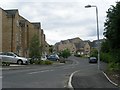
9
Birkhouse Lane, Clifton
The path was part of Birkhouse Lane in 1850 before the railway was constructed. A narrow bridge was provided under the railway, only wide enough for a footway, and the road was diverted to pass under the railway to the north and along the east side of the railway. The part up to the hamlet of Birkhouse can be seen in the distance, now called Birkhouse Road. The footpath under the railway has become obstructed, and people walk over the railway embankment.
Image: © Humphrey Bolton
Taken: 9 Oct 2006
0.06 miles
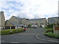
10
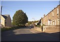
Birkhouse Road, Clifton
Terrace houses probably built for workers in the mills down in the valley.
Image: © Humphrey Bolton
Taken: 9 Oct 2006
0.07 miles