IMAGES TAKEN NEAR TO
Royds Avenue, BRIGHOUSE, HD6 4EG

Introduction

This page details the photographs taken nearby to Royds Avenue, HD6 4EG by members of the Geograph project.

The Geograph project started in 2005 with the aim of publishing, organising and preserving representative images for every square kilometre of Great Britain, Ireland and the Isle of Man.

There are currently over 7.5m images from over14,400 individuals and you can help contribute to the project by visiting https://www.geograph.org.uk

Image Map


Images are licensed for reuse under creativecommons.org/licenses/by-sa/2.0
Notes
  • Clicking on the map will re-center to the selected point.
  • The higher the marker number, the further away the image location is from the centre of the postcode.

Image Listing (151 Images Found)

Images are licensed for reuse under creativecommons.org/licenses/by-sa/2.0
  • ...
Image
Details
Distance
1
Lower Wyke Lane - off Wyke Old Lane
Image: © Betty Longbottom Taken: 4 Jul 2009
0.01 miles
2
Royds Avenue, Bailiff Bridge
Image: © habiloid Taken: 26 Jul 2020
0.01 miles
3
Royds Avenue - Wyke Old Lane, Bailiff Bridge
Image: © Betty Longbottom Taken: 19 Apr 2008
0.01 miles
4
Royds Avenue - viewed from Mayfield Avenue
Image: © Betty Longbottom Taken: 4 Jul 2009
0.01 miles
5
View from a disused railway line near Lower Wyke Lane, Bailiff Bridge
Image: © habiloid Taken: 26 Jul 2020
0.03 miles
6
Former Bridge BRB-BHS 07 - Lower Wyke Lane
Image: © Betty Longbottom Taken: 19 Apr 2008
0.03 miles
7
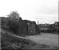
Old bridge abutment on Pickle Bridge branch
The Pickle Bridge branch, which served also a station at Brighouse Clifton Road, was the most direct rail route from Bradford to Huddersfield. In 1987 this bridge abutment still remained.
Image: © Dr Neil Clifton Taken: 21 Apr 1987
0.04 miles
8
Lower Wyke Lane, Bailiff Bridge
A path leaves the road to follow a disused railway line. The remains of the bridge over the road can be seen.
Image: © habiloid Taken: 26 Jul 2020
0.04 miles
9
Disused railway bridge abutment, Lower Wyke Lane, Wyke
A path has been trodden up onto the railway embankment. One day I will go up it and find out how far it goes.
Image: © Humphrey Bolton Taken: 23 Aug 2023
0.04 miles
10
Lower Wyke Lane
Image: © Colin Pyle Taken: 14 Jul 2018
0.05 miles
  • ...