IMAGES TAKEN NEAR TO
Lower Edge Road, BRIGHOUSE, HD6 3NT
Introduction
This page details the photographs taken nearby to Lower Edge Road, HD6 3NT by members of the Geograph project.
The Geograph project started in 2005 with the aim of publishing, organising and preserving representative images for every square kilometre of Great Britain, Ireland and the Isle of Man.

There are currently over 7.5m images from over14,400 individuals and you can help contribute to the project by visiting https://www.geograph.org.uk
Image Map
Images are licensed for reuse under creativecommons.org/licenses/by-sa/2.0
Notes
- Clicking on the map will re-center to the selected point.
- The higher the marker number, the further away the image location is from the centre of the postcode.
Image Listing (204 Images Found)
Images are licensed for reuse under creativecommons.org/licenses/by-sa/2.0
Image
Details
Distance
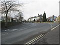
1
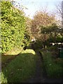
Back lane behind Tofts Grove
This looks like a country lane, but gives access to the back gardens of the terrace houses at the top of Tofts Grove.
Image: © Humphrey Bolton
Taken: 12 Nov 2005
0.01 miles
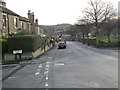
2
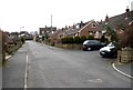
Mayster Grove, Rastrick (SE134213)
This road started at the top, at Lower Edge Road, and has been extended in stages until it reached Field Lane. This is the top end, and the turning bay probably indicates its original extent.
Image: © Humphrey Bolton
Taken: 27 Feb 2006
0.01 miles
4
Mayster Grove seen from Lower Edge Road, Rastrick
Image: © habiloid
Taken: 7 May 2022
0.01 miles
5
Delf Hill - viewed from Highfield Road
Image: © Betty Longbottom
Taken: 24 Dec 2013
0.02 miles
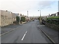
6
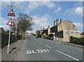
Lower Edge Road, Rastrick
Approaching the junction with Mayster Grove on the right and Highbury Special School on the left.
Image: © Humphrey Bolton
Taken: 20 Apr 2013
0.03 miles
8
Delf Hill - viewed from Highfield Road
Image: © Betty Longbottom
Taken: 24 Dec 2013
0.04 miles
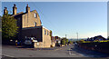
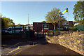
9
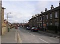
Highfield Road, Rastrick (SE133213)
The terrace of 19C houses was along a cul-de-sac off Lower Edge Road, but this road was adopted and widened to form part of the council estate.
Image: © Humphrey Bolton
Taken: 27 Feb 2006
0.05 miles
10
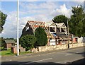
Bungalow extending upwards, off Lower Edge Road, Rastrick
This was a school caretaker's bungalow, and is now being enlarged by the addition of first-floor rooms in a new roof.
Image: © Humphrey Bolton
Taken: 17 Jun 2007
0.05 miles