1
Back Close Lea, Rastrick
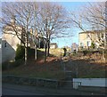
Although Close Lea is a 20C housing estate road, the houses at the northern end, on the left of the image, are older. The houses straight ahead are on Longroyde Road.
Image: © Humphrey Bolton
Taken: 17 Dec 2010
0.01 miles
2
Building site off Thornhill Road, Rastrick
There were two large houses here, originally (in 1854) one house called Thorncliff Villa and an adjoining building that might have been a coach house. This view is from Back Close Lea, by the usual method of poking the camera through the site fencing.
Image: © Humphrey Bolton
Taken: 17 Dec 2010
0.01 miles
3
Longroyde School, Close Lea, Rastrick
Part of the main school building can be seen beyond the flat-roofed building.
Image: © Humphrey Bolton
Taken: 17 Dec 2010
0.01 miles
4
Close Lea, Rastrick
Image: © JThomas
Taken: 6 Mar 2020
0.02 miles
5
#100 Thornhill Road
Image: © Roger Templeman
Taken: 18 Jul 2018
0.03 miles
6
Houses at the bend in Close Lea
Image: © Roger Templeman
Taken: 18 Jul 2018
0.03 miles
7
Benchmark on wall in front of #100 Thornhill Road at #102 junction
Ordnance Survey cut mark benchmark described on the Bench Mark Database at www.bench-marks.org.uk/bm41905
Image: © Roger Templeman
Taken: 18 Jul 2018
0.04 miles
8
Ordnance Survey Cut Mark
This mark can be found on the roadside garden wall of 100 Thornhill Road.
For more details see : http://www.bench-marks.org.uk/bm41905
Image: © Peter Wood
Taken: 13 Mar 2012
0.04 miles
9
Letter box, Thornhill Road, Rastrick
Letter box HD6 270, an EiiR wall box, molested by graffiti vandals. The road to the left is Longroyde Road, and ahead 19C terrace houses on the right and council flats on the left on what were allotments.
Image: © Humphrey Bolton
Taken: 5 Jan 2009
0.05 miles
10
Steps from Denham Street to Bramston Street, Rastrick
Not an old footpath, but it seems that this part of the hillside has never been built on and probably so many people walked down the slope that the council were eventually persuaded to make some steps.
Image: © Humphrey Bolton
Taken: 17 Dec 2010
0.05 miles


