1
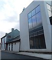
Casa Restaurant
Image: © Anthony Parkes
Taken: 9 Mar 2015
0.05 miles
2
View of Grove, Southowram, Yorkshire
This is a view across the Calder valley from the footpath on the edge of the escarpment in Rastrick, and shows two terraces of 19C houses, Grove Cottages and Grove Terrace, originally back-to-backs. These are off the A6025 and were possibly built for quarry workers as there does not appear to have been a mill nearby. To the left of them is a hotel above the end of the water skiing lake, and at the top left of the picture a stone processing works associated with Cromwell Quarries.
Image: © Humphrey Bolton
Taken: 16 Feb 2006
0.05 miles
3
Track junction, Cromwell Wood Lane, Brookfoot, Southowram
To the right, Cromwell Wood Lane goes down to Elland Road opposite North Cut at Brookfoot. The track to the left is a public footpath leading via Cromwell Bottom Delf to Brookfoot Lane.
Image: © Humphrey Bolton
Taken: 7 Apr 2007
0.07 miles
4
Footpath in Freeman's Wood
Image: © Chris Wimbush
Taken: 28 Aug 2011
0.08 miles
5
Casa hotel and restaurant, Elland Road, Southowram
Image: © Humphrey Bolton
Taken: 5 Apr 2023
0.08 miles
6
Junction of tracks in Freemans Wood, Southowram
The track to the left is Cromwell Wood Lane, part of Brighouse FP46, and the one to the left loops round via Delf Hill, and is part of FP45.
Image: © Humphrey Bolton
Taken: 13 Apr 2017
0.08 miles
7
Bluebells in mid-April, Cromwell Wood Lane, Southowram
This was taken on 17th April, after unusually warm and sunny weather.
Image: © Humphrey Bolton
Taken: 17 Apr 2007
0.09 miles
8
The Calder and Hebble Navigation west of Brookfoot Lock
Image: © habiloid
Taken: 15 Apr 2022
0.10 miles
9
Artificial lakes in the Calder Valley
A view from Strangstry Wood looking down on the various former gravel pits either side of the Calder and Hebble Navigation, that are now used as recreational lakes.
Image: © Stephen Craven
Taken: 7 Apr 1991
0.11 miles
10
Unexpected barbecue, Southowram
Two tracks leads up from Cromwell Wood Lane; the first is a footpath to Brookfoot Lane, and the second stops at a bank of backfilled material. On scrambling to the top of this, there is this area with circular flagstones and a fireplace which probably serves as a barbecue. The notice on the green wotsit says 'Marshall's property keep out', and to the left of it a little storage cabin.
Image: © Humphrey Bolton
Taken: 17 Apr 2007
0.11 miles


