IMAGES TAKEN NEAR TO
Hove Edge, BRIGHOUSE, HD6 2LP
Introduction
This page details the photographs taken nearby to HD6 2LP by members of the Geograph project.
The Geograph project started in 2005 with the aim of publishing, organising and preserving representative images for every square kilometre of Great Britain, Ireland and the Isle of Man.

There are currently over 7.5m images from over14,400 individuals and you can help contribute to the project by visiting https://www.geograph.org.uk
Image Map
Images are licensed for reuse under creativecommons.org/licenses/by-sa/2.0
Notes
- Clicking on the map will re-center to the selected point.
- The higher the marker number, the further away the image location is from the centre of the postcode.
Image Listing (50 Images Found)
Images are licensed for reuse under creativecommons.org/licenses/by-sa/2.0
Image
Details
Distance
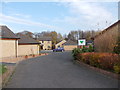
1
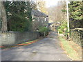
Driveway to Giles House - Newton Park
Image: © Betty Longbottom
Taken: 16 Nov 2012
0.03 miles
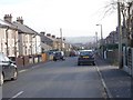
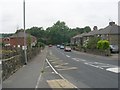
2
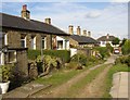
Hill Crest, Hove Edge, Brighouse
An unusual development of terraced bungalows built before 1907. At SE133242.
Image: © Humphrey Bolton
Taken: 22 Aug 2005
0.06 miles
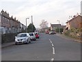
3
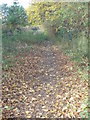
St Giles Road - Lower Finkil Street
Image: © Betty Longbottom
Taken: 16 Nov 2012
0.06 miles
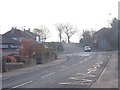
4
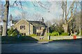
Lower Green House, Hove Edge
This house was probably built in the early 18C (from a dated fireplace) and is listed, Grade II.
Image: © Humphrey Bolton
Taken: 19 Jan 2023
0.09 miles
8
Finkil Street - viewed from Green Lane
Image: © Betty Longbottom
Taken: 16 Nov 2012
0.10 miles
10
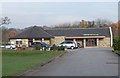
Crow Nest Park Golf Club House - Newton Park
Image: © Betty Longbottom
Taken: 16 Nov 2012
0.12 miles