IMAGES TAKEN NEAR TO
Lightcliffe Road, BRIGHOUSE, HD6 2HJ

Introduction

This page details the photographs taken nearby to Lightcliffe Road, HD6 2HJ by members of the Geograph project.

The Geograph project started in 2005 with the aim of publishing, organising and preserving representative images for every square kilometre of Great Britain, Ireland and the Isle of Man.

There are currently over 7.5m images from over14,400 individuals and you can help contribute to the project by visiting https://www.geograph.org.uk

Image Map


Images are licensed for reuse under creativecommons.org/licenses/by-sa/2.0
Notes
  • Clicking on the map will re-center to the selected point.
  • The higher the marker number, the further away the image location is from the centre of the postcode.

Image Listing (137 Images Found)

Images are licensed for reuse under creativecommons.org/licenses/by-sa/2.0
  • ...
Image
Details
Distance
1
GW Animal Feeds, Lightcliffe Road, Brighouse
This building is captioned 'Smithy' on the late 19C 1:2500 map. It has probably been rebuilt.
Image: © Humphrey Bolton Taken: 12 Jan 2023
0.00 miles
2
Lightcliffe Road - viewed from Granny Hall Lane
Image: © Betty Longbottom Taken: 27 Jun 2009
0.03 miles
3
Benchmark on wall corner at Granny Hall Lane / Lightcliffe Road junction
Ordnance Survey cut mark benchmark described on the Bench Mark Database at www.bench-marks.org.uk/bm49304
Image: © Roger Templeman Taken: 27 Jul 2018
0.03 miles
4
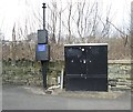
Gas Installation - Granny Hall Lane
Image: © Betty Longbottom Taken: 7 Apr 2013
0.04 miles
5
Wall at Granny Hall Lane / Lightcliffe Road junction
The wall encloses Pond Quarry (disused). There is an OS benchmark Image on the corner of the wall
Image: © Roger Templeman Taken: 27 Jul 2018
0.04 miles
6
Granny Hall Lane - Lightcliffe Road
Image: © Betty Longbottom Taken: 27 Jun 2009
0.04 miles
7
Pond Quarry, Lightcliffe Road (2), Brighouse
Another view of the quarry showing a cliff face in the centre. The lodge of the Cemetery on Lightcliffe Road can be seen in the background.
Image: © Humphrey Bolton Taken: 21 Nov 2006
0.05 miles
8
Houses on the bend, Lightcliffe Road, Brighouse
The upper pair, actually just in SE1424, is dated 1906. The bend in the road has been eased at some time, and the footway is at a lower level behind the raised verge. The road on the right is Bracken Road.
Image: © Humphrey Bolton Taken: 21 Nov 2006
0.05 miles
9
Smith Carr Lane - Lightcliffe Road
Image: © Betty Longbottom Taken: 27 Jun 2009
0.05 miles
10
St Andrew's Drive - Lightcliffe Road
Image: © Betty Longbottom Taken: 27 Jun 2009
0.05 miles
  • ...