IMAGES TAKEN NEAR TO
St. John Street, BRIGHOUSE, HD6 1HN
Introduction
This page details the photographs taken nearby to St. John Street, HD6 1HN by members of the Geograph project.
The Geograph project started in 2005 with the aim of publishing, organising and preserving representative images for every square kilometre of Great Britain, Ireland and the Isle of Man.

There are currently over 7.5m images from over14,400 individuals and you can help contribute to the project by visiting https://www.geograph.org.uk
Image Map
Images are licensed for reuse under creativecommons.org/licenses/by-sa/2.0
Notes
- Clicking on the map will re-center to the selected point.
- The higher the marker number, the further away the image location is from the centre of the postcode.
Image Listing (628 Images Found)
Images are licensed for reuse under creativecommons.org/licenses/by-sa/2.0
Image
Details
Distance
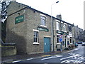
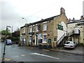
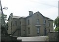
1
Sunday School, St John's Street, Rastrick
St John's School was built in 1874, and presumably this became the Sunday School pictured here. It is older than the present church, the belfry of which can be seen in the top right of the photo.
Image: © Humphrey Bolton
Taken: 7 Aug 2006
0.03 miles
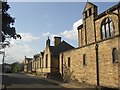
2
Sunday School, St John's Street, Rastrick
This was an Anglican school built in 1874, and I think served it also as a church before the present church was built in 1915 (see Image). Note the cross on the gable. It is now the Sunday School.
Image: © Humphrey Bolton
Taken: 15 Aug 2008
0.03 miles
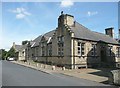
5
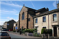
Brighouse: Church of St. John the Divine, Gooder Lane
Image: © Dr Neil Clifton
Taken: 9 Jul 2010
0.04 miles
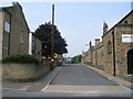
6
Laura Street - Gooder Lane
The white building on the right was the subject of an explosion and fire in the early hours of the 30th June 2009
Image: © Betty Longbottom
Taken: 29 Jun 2009
0.04 miles
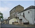
7
Disused Flour Mill, Brighouse
On the left are the offices, built before 1907, but probably fairly new then. The building on the right must be 20s or 30s at a guess, with features that perhaps could be called Art Deco. The site is now owned by Younger Homes, and is to be redeveloped.
Image: © Humphrey Bolton
Taken: 17 Dec 2005
0.04 miles
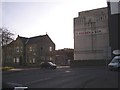
9

Electricity Substation No 1841 - Bridge End
Image: © Betty Longbottom
Taken: 30 Jul 2013
0.05 miles