1
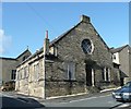
St Joseph's Catholic Church, Brighouse
Image: © Stephen Armstrong
Taken: 11 Dec 2009
0.02 miles
2
High Street, Brighouse
This High Street is not the main street in the town, but a Victorian residential road.
Image: © Humphrey Bolton
Taken: 10 Apr 2006
0.03 miles
3
National Spiritualist Church, Eastwood Street, Brighouse
At the junction with Martin Street. This building is labelled 'Hall' on the 1907 map, and might have belonged to the adjacent Catholic church.
Image: © Humphrey Bolton
Taken: 8 Sep 2006
0.03 miles
4
High Street
Image: © Tim Marchant
Taken: 23 Jun 2008
0.03 miles
5
Spiritual Church, Eastwood Street, Brighouse
The sun on the front picks out the carved words: Mission Hall in the gable, which I missed when I took
Image There is another change: the board near the corner has gone, so perhaps the spiritualist have left and gone elsewhere.
Image: © Humphrey Bolton
Taken: 8 Oct 2008
0.03 miles
6
St Joseph's Catholic Church - Martin Street
Image: © Betty Longbottom
Taken: 28 Jul 2007
0.04 miles
7
Green Alkanet, Brighouse
This is part of a colony of Pentaglossis sempervirens that is thriving on the thin soil that has built up at the edge of the paving at the foot of the steps up to the Roman Catholic Church car park. W Keble Martin calls it a 'garden escape' and it may well have grown from seed that has come from the garden at the entrance to the Bradford Road subway not far away. It produces small black seeds, which might possibly be transported by birds. He is out-of-date with the flowering period, stating May to August whilst in now starts flowering in early April. The prefix 'green' distinguishes the plant from Alkanet, Alkana tintoria, which was introduced in the Middle Ages for the red dye obtained from its roots.
Image: © Humphrey Bolton
Taken: 18 Apr 2022
0.04 miles
8
Dentist, Bradford Road, Brighouse
These look to have been built as rather superior terrace houses, the one on the right being double-fronted and quite large. Two of them are now occupied by a dental practice - note the large tooth hung up by the door!
Image: © Humphrey Bolton
Taken: 8 Sep 2006
0.04 miles
9
Restaurant and Liberal Club, Bradford Road, Brighouse
The Liberal Club was built in 1877. On the 1907 1:2500 map a gap was shown between the buildings, and close examination shows that the right-most bay of the Great Wall of China has been very skilfully added at some stage, with only slight discrepancies in the courses of stone and in the gutter.
Image: © Humphrey Bolton
Taken: 8 Sep 2006
0.04 miles
10
Martin Street, Brighouse
On the left, part of a row of terrace houses with fancy lintels. To the right a large building containing shops facing Bradford Road.
Image: © Humphrey Bolton
Taken: 8 Sep 2006
0.04 miles


