IMAGES TAKEN NEAR TO
Houses Hill, HUDDERSFIELD, HD5 0NU
Introduction
This page details the photographs taken nearby to Houses Hill, HD5 0NU by members of the Geograph project.
The Geograph project started in 2005 with the aim of publishing, organising and preserving representative images for every square kilometre of Great Britain, Ireland and the Isle of Man.

There are currently over 7.5m images from over14,400 individuals and you can help contribute to the project by visiting https://www.geograph.org.uk
Image Map
Images are licensed for reuse under creativecommons.org/licenses/by-sa/2.0
Notes
- Clicking on the map will re-center to the selected point.
- The higher the marker number, the further away the image location is from the centre of the postcode.
Image Listing (18 Images Found)
Images are licensed for reuse under creativecommons.org/licenses/by-sa/2.0
Image
Details
Distance
1
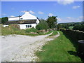
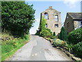
South Royd
The shortcut from the Lane runs right in front of the house South Royd
Image: © Stanley Walker
Taken: 26 Jul 2008
0.01 miles
4
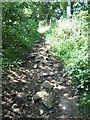
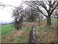
Long Tongue Scrog Lane, Houses Hill
As you can see the path is now edged by bushes and trees so this is probably how the name Scrog came to be used, one definition I came across used in the North of England and Scotland was that Scrog is any natural stunted tree or bush don't know about the Long Tongue part though. I also see that the path has been cobbled at some time in the past so must have been used extensively as there was Levi's Mill just across the fields at Gawthorpe Green.
Image: © Stanley Walker
Taken: 26 Jul 2008
0.08 miles
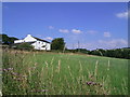
5
Paved section of Long Tongue Scrog Lane
Image: © John Slater
Taken: 30 Jan 2014
0.09 miles
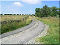
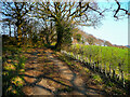
6
Long Tongue Scrog Lane, Kirkheaton
This is where the bridleway leaves the part that has been widened for motor vehicles and continues across the hillside to Houses Hill. Its original name was Houses Lane.
Image: © Humphrey Bolton
Taken: 28 Feb 2021
0.15 miles
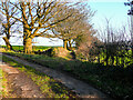
7
Lane to Carr Mount, Kirkheaton
The lane ended somewhere near here in the 19C, and becomes a driveway to a pair of houses, built in the 20C. The public footpath on the lane goes to the right on its original route.
Image: © Humphrey Bolton
Taken: 28 Feb 2021
0.17 miles
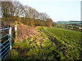
8
Recently planted hedge alongside Long Tongue Scrog Lane, Kirkheaton
Probably hawthorn saplings.
Image: © Humphrey Bolton
Taken: 28 Feb 2021
0.18 miles
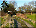
10
Footpath junction near Carr Mount, Kirkheaton
The path to Carr Mount goes to the left and joins a private lane to Carr Mount. The lane continues to Bellstring Lane but not as a public right-of-way. The path straight on goes to Hagg Farm.
Image: © Humphrey Bolton
Taken: 28 Feb 2021
0.19 miles