IMAGES TAKEN NEAR TO
Craven Street, HUDDERSFIELD, HD4 5TG
Introduction
This page details the photographs taken nearby to Craven Street, HD4 5TG by members of the Geograph project.
The Geograph project started in 2005 with the aim of publishing, organising and preserving representative images for every square kilometre of Great Britain, Ireland and the Isle of Man.

There are currently over 7.5m images from over14,400 individuals and you can help contribute to the project by visiting https://www.geograph.org.uk
Image Map
Images are licensed for reuse under creativecommons.org/licenses/by-sa/2.0
Notes
- Clicking on the map will re-center to the selected point.
- The higher the marker number, the further away the image location is from the centre of the postcode.
Image Listing (121 Images Found)
Images are licensed for reuse under creativecommons.org/licenses/by-sa/2.0
Image
Details
Distance
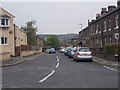
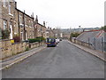
1
Craven Street - viewed from Bowling Street
Image: © Betty Longbottom
Taken: 10 May 2016
0.01 miles
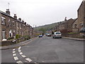
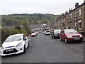
2
Bowling Street - viewed from Craven Street
Image: © Betty Longbottom
Taken: 10 May 2016
0.01 miles
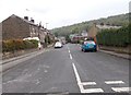
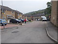
6
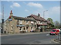
The Horse and Groom,Manchester Road A62, Milnsbridge (Huddersfield, ex-Linthwaite)
Next to it a pair of houses with a semi-hipped roof, and an arched-top staircase window just visible.
Image: © Humphrey Bolton
Taken: 8 May 2008
0.03 miles
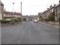
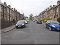
7
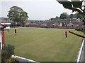
Milnsbridge Bowling Club Green - viewed from Bowling Street
Image: © Betty Longbottom
Taken: 10 May 2016
0.03 miles