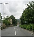
IMAGES TAKEN NEAR TO
Deep Lane, HUDDERSFIELD, HD4 5SJ

Introduction

This page details the photographs taken nearby to Deep Lane, HD4 5SJ by members of the Geograph project.

The Geograph project started in 2005 with the aim of publishing, organising and preserving representative images for every square kilometre of Great Britain, Ireland and the Isle of Man.

There are currently over 7.5m images from over14,400 individuals and you can help contribute to the project by visiting https://www.geograph.org.uk

Image Map


Images are licensed for reuse under creativecommons.org/licenses/by-sa/2.0
Notes
  • Clicking on the map will re-center to the selected point.
  • The higher the marker number, the further away the image location is from the centre of the postcode.

Image Listing (203 Images Found)

Images are licensed for reuse under creativecommons.org/licenses/by-sa/2.0
  • ...
Image
Details
Distance
1
Deep Lane - Manchester Road
Image: © Betty Longbottom Taken: 10 May 2016
0.01 miles
2
Burial Ground - Deep Lane
Image: © Betty Longbottom Taken: 10 May 2016
0.01 miles
3
Manchester Road - viewed from Whiteley Street
Image: © Betty Longbottom Taken: 10 May 2016
0.02 miles
4
Chapel - Burial Ground - Deep Lane
Image: © Betty Longbottom Taken: 10 May 2016
0.02 miles
5
George VI postbox on Manchester Road, Huddersfield
Postbox No. HD4 39. See Image] for context.
Image: © JThomas Taken: 2 Nov 2018
0.02 miles
6
Vitality Centre, Huddersfield
Showing position of Postbox No. HD4 39. See Image] for postbox.
Image: © JThomas Taken: 2 Nov 2018
0.02 miles
7
Huddersfield Narrow Canal, Milnsbridge
Looking west along the canal towards locks 9E and 10E prior to restoration. The locks had been "cascaded", that is to say their gates were removed, the chamber walls partially removed and they were partly infilled to create a series of small waterfalls. After much effort, pioneered by the Huddersfield Canal Society this process has now been reversed and the canal is once again navigable. The old mill on the right has been demolished and replaced by a modern block of flats however many of the other buildings still survive.
Image: © David Stowell Taken: 13 Apr 1975
0.03 miles
8
Huddersfield Narrow Canal Milnsbridge
Image: © Chris Wimbush Taken: 15 Aug 2010
0.03 miles
9
Whiteley Street - Milnsbridge
Image: © Betty Longbottom Taken: 8 Aug 2008
0.03 miles
10
Whiteley Street Joins Manchester Road at Milnsbridge
Image: © Raymond Knapman Taken: 11 Apr 2014
0.03 miles
  • ...