1
The Slip Inn
Image: © John Slater
Taken: 11 Oct 2014
0.02 miles
2
Longwood Mechanics Hall
A smart new entrance in stonework replaces the rather dilapidated wooden structure that I remember from my early years in Longwood (see Humphrey Burton's pic). My mother and stepfather were caretakers for a number of years in 1950s/60s before moving to Rock Street. Their two-storey dwelling (one of two originally) located at the lower level rear and overlooking the allotments is now bricked up and unused for a dwelling. The highlight of the year was the annual concert by the Longwood Amateur Operatic Society. The seemingly interminable rehearsals beforehand dinned every song into my head as firmly as for the cast. I was word perfect in my time with such shows as 'The Desert Song', "No,No Nanette', etc. They were big rivals of the other local group The Lindley AOS.
Image: © Peter Turner
Taken: 13 Oct 2011
0.03 miles
3
Edge Terrace, Longwood
The house on the left is called 'The Cottage' on the 1850 6” map, and has two sets of 'weavers' windows', perhaps from the early 19C as the lights are quite large. There was a school on the grassy area to the left.
Image: © Humphrey Bolton
Taken: 20 May 2007
0.04 miles
4
Lodge Rooms, Longwood Gate, Longwood
This name is carved in stone, with the date 1881 (or 1887?), so presumably it was built as a lodging house with rooms that would now be called bed-sits.
Image: © Humphrey Bolton
Taken: 20 May 2007
0.04 miles
5
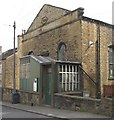
Mechanics Hall, Longwood Gate, Longwood.
Most of these are now used for other purposes, but this still seems to be a meeting hall. The porch is quite a period piece, perhaps added in the early 20C?. The date carved in stone on the gable is 1858.
Image: © Humphrey Bolton
Taken: 20 May 2007
0.04 miles
6
The Slip Inn, Longwood Gate, Longwood
This proudly carries the date 1927, and in ghostly letters 'Bentley and Shaw'. Bentley and Shaw’s Brewery was at Lockwood, and had its own spa well known as Horse Bank Well. They were taken over by Hammonds in 1944.
Image: © Humphrey Bolton
Taken: 20 May 2007
0.04 miles
7
Spark Street Longwood
At the top of the steep cobbled hill of Spark Street, on Longwood Gate to the left, was the Baptist Sunday School where for 10 years I was a regular attender morning and afternoon. I have the books chosen by me as special prizes to be received on Prizegiving Day and a King James Bible presented for learning and reciting various psalms as evidence. I haven't suffered too much as a consequence. To the right was my first school now demolished.
Image: © Peter Turner
Taken: 29 Jan 2003
0.07 miles
8
Footpath from Longwood Gate to Edge Terrace
Image: © Chris Wimbush
Taken: 30 Jul 2011
0.08 miles
9
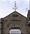
Finial, Spark Hall Terrace, Longwood
This is on a gable at the centre of the terrace, in Spark Street. The date is 1878 and the name of the terrace, deciphered after much peering, is across the gable just below eaves level. The asymmetry of the finial gives it a lively appearance.
Image: © Humphrey Bolton
Taken: 20 May 2007
0.09 miles
10
Spark Street, Longwood
Not the ideal terrain for building houses, but they were needed close to the mills in the valley bottom. Spark Hall Terrace is on the left. The gently sloping hillside of Golcar Flat is in the distance.
Image: © Humphrey Bolton
Taken: 20 May 2007
0.09 miles


