IMAGES TAKEN NEAR TO
Quarmby Clough, HUDDERSFIELD, HD3 4UN

Introduction

This page details the photographs taken nearby to Quarmby Clough, HD3 4UN by members of the Geograph project.

The Geograph project started in 2005 with the aim of publishing, organising and preserving representative images for every square kilometre of Great Britain, Ireland and the Isle of Man.

There are currently over 7.5m images from over14,400 individuals and you can help contribute to the project by visiting https://www.geograph.org.uk

Image Map


Images are licensed for reuse under creativecommons.org/licenses/by-sa/2.0
Notes
  • Clicking on the map will re-center to the selected point.
  • The higher the marker number, the further away the image location is from the centre of the postcode.

Image Listing (75 Images Found)

Images are licensed for reuse under creativecommons.org/licenses/by-sa/2.0
  • ...
Image
Details
Distance
1
Ballroyd Clough - Thornhill Road
Image: © Betty Longbottom Taken: 11 Jan 2016
0.04 miles
2
Nab End Tower in 1999
The tower carries an 1861 date stone around the other side to this view
Image: © Kevin Waterhouse Taken: Unknown
0.07 miles
3
Vicarage Road - viewed from Thornhill Road
Image: © Betty Longbottom Taken: 11 Jan 2016
0.07 miles
4
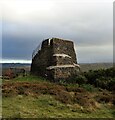
Nab End Tower
With security fencing to guard against entry to the adjacent quarry
Image: © Kevin Waterhouse Taken: 20 Nov 2021
0.07 miles
5
Thornhill Road, Longwood
This is below the tower at Nab End, and dipping down into Quarmby Clough. Unlike the Longwood Valley, Quarmby Clough has largely escaped development, although Quarmby Clough Mills (now demolished) were just above the road as it crossed the valley.
Image: © Humphrey Bolton Taken: 24 Sep 2005
0.07 miles
6
Footpath - Vicarage Road
Image: © Betty Longbottom Taken: 11 Jan 2016
0.09 miles
7
Victorian Amphitheatre
At Nab End, Longwood. The structure carries a date of 1873 and rebuilt 1930
Image: © Kevin Waterhouse Taken: 20 Nov 2021
0.09 miles
8
Longwood Tower, Nab End
Whose idea it was to try to fence it off I don't know, but people-power has kept it open.
Image: © Humphrey Bolton Taken: 20 May 2007
0.09 miles
9
Longwood Tower, Nab End
Dated 1861. Built by unemployed men.
Image: © Humphrey Bolton Taken: 20 May 2007
0.09 miles
10
View from Nab End, Longwood
This is the view over Milnsbridge. Back Thornhill Road is down below, then an undeveloped area with trees. The new housing estate has replaced mill buildings, then the railway viaduct crosses the valley. The district of Crosland Moor is in the distance.
Image: © Humphrey Bolton Taken: 20 May 2007
0.09 miles
  • ...