IMAGES TAKEN NEAR TO
Stoney Lane, HUDDERSFIELD, HD3 4TL
Introduction
This page details the photographs taken nearby to Stoney Lane, HD3 4TL by members of the Geograph project.
The Geograph project started in 2005 with the aim of publishing, organising and preserving representative images for every square kilometre of Great Britain, Ireland and the Isle of Man.

There are currently over 7.5m images from over14,400 individuals and you can help contribute to the project by visiting https://www.geograph.org.uk
Image Map
Images are licensed for reuse under creativecommons.org/licenses/by-sa/2.0
Notes
- Clicking on the map will re-center to the selected point.
- The higher the marker number, the further away the image location is from the centre of the postcode.
Image Listing (104 Images Found)
Images are licensed for reuse under creativecommons.org/licenses/by-sa/2.0
Image
Details
Distance
2
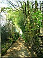
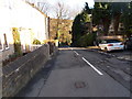
Path from Golcar to Longwood.
This pathway runs from near the lower end of Leymoor Road into Longwood.
Image: © Andrew Loughran
Taken: 6 Jul 2006
0.04 miles
7
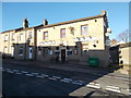
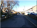
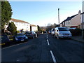
Leymoor Road - viewed from Sycamore Avenue
Image: © Betty Longbottom
Taken: 29 Dec 2015
0.08 miles
8
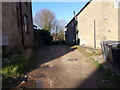
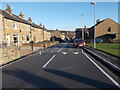
Ayton Road - looking towards Grange Road
Image: © Betty Longbottom
Taken: 29 Dec 2015
0.09 miles
10
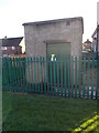
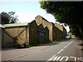
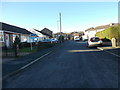
Electricity Substation No 451 - off Sycamore Road
Image: © Betty Longbottom
Taken: 29 Dec 2015
0.10 miles