IMAGES TAKEN NEAR TO
Meg Lane, HUDDERSFIELD, HD3 4QP
Introduction
This page details the photographs taken nearby to Meg Lane, HD3 4QP by members of the Geograph project.
The Geograph project started in 2005 with the aim of publishing, organising and preserving representative images for every square kilometre of Great Britain, Ireland and the Isle of Man.

There are currently over 7.5m images from over14,400 individuals and you can help contribute to the project by visiting https://www.geograph.org.uk
Image Map
Images are licensed for reuse under creativecommons.org/licenses/by-sa/2.0
Notes
- Clicking on the map will re-center to the selected point.
- The higher the marker number, the further away the image location is from the centre of the postcode.
Image Listing (152 Images Found)
Images are licensed for reuse under creativecommons.org/licenses/by-sa/2.0
Image
Details
Distance
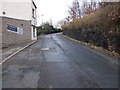
1
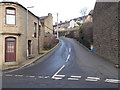
Longwood Road - viewed from Vicarage Road
Image: © Betty Longbottom
Taken: 11 Jan 2016
0.02 miles
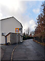
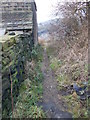
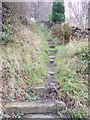
3
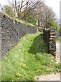
Footpath off Meg Lane, Longwood
Goes up to Longwood Road, and was the only access to a few properties as shown on the 1850 map.
Image: © Humphrey Bolton
Taken: 19 Apr 2007
0.03 miles
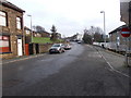
4
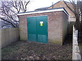
Electricity Substation No 617 - Meg Lane
Image: © Betty Longbottom
Taken: 11 Jan 2016
0.03 miles
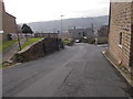
8
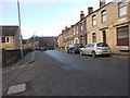
Vicarage Road - viewed from Longwood Road
Image: © Betty Longbottom
Taken: 11 Jan 2016
0.04 miles