1
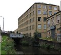
Huddersfield Narrow Canal towards lock #8E
Image: © Ian S
Taken: 27 Jul 2016
0.00 miles
2
Lockbridge Way, Milnsbridge
Image: © habiloid
Taken: 21 Feb 2022
0.01 miles
3
Lock 7E on Huddersfield Narrow Canal
Image: © Chris Morgan
Taken: 24 Jul 2013
0.01 miles
4
Lock 8E, Huddersfield Narrow Canal
Image: © Ian S
Taken: 27 Jul 2016
0.02 miles
5
Lock 8E, The Huddersfield Narrow Canal
Image: © habiloid
Taken: 21 Feb 2022
0.02 miles
6
Lock No 8E, Huddersfield Narrow Canal
Looking east. Union Mill is on the left, with Burdett Mill just visible of the extreme right.
Image: © Dr Neil Clifton
Taken: 7 Jul 2003
0.02 miles
7
Canal scene at Milnsbridge
Taken on a somewhat overcast day, the low light levels lend a slightly gloomy feel to this image of the Huddersfield Narrow Canal viewed towards Factory Lane bridge (No.31). The building to the right of the canal, part of Union Mills, looks as though it has now been converted into apartments.
Image: © Bobby Clegg
Taken: 30 Aug 2012
0.02 miles
8
Towards Lock No 8E, Huddersfield Narrow Canal
Looking west, the heavily industrialised surroundings are evident. Union Mill is to the right, and Burdett Mill on the left. The lane that crosses the bridge just before the lock is called, appropriately enough, Factory Lane.
Image: © Dr Neil Clifton
Taken: 7 Jul 2003
0.02 miles
9
Burdett Court, Factory Lane, Milnsbridge, Linthwaite
I think this is the Spring and Burdett Mill (woollen) building shown on the 1859 6in map. The tower seems to belong to a similar building on the other side of the canal, also converted to apartments.
Image: © Humphrey Bolton
Taken: 6 Dec 2007
0.02 miles
10
Union Mills, Milnsbridge
Once part of the huge John Crowther textile empire, they are now apartments. Burdett Mill on the right has had a similar fate. A slightly earlier photo is seen here
Image
Image: © Chris Allen
Taken: 17 Aug 2002
0.02 miles


