IMAGES TAKEN NEAR TO
Farm Road, NORTHWOOD, HA6 2NZ
Introduction
This page details the photographs taken nearby to Farm Road, HA6 2NZ by members of the Geograph project.
The Geograph project started in 2005 with the aim of publishing, organising and preserving representative images for every square kilometre of Great Britain, Ireland and the Isle of Man.

There are currently over 7.5m images from over14,400 individuals and you can help contribute to the project by visiting https://www.geograph.org.uk
Image Map
Images are licensed for reuse under creativecommons.org/licenses/by-sa/2.0
Notes
- Clicking on the map will re-center to the selected point.
- The higher the marker number, the further away the image location is from the centre of the postcode.
Image Listing (55 Images Found)
Images are licensed for reuse under creativecommons.org/licenses/by-sa/2.0
Image
Details
Distance
5
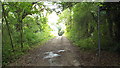
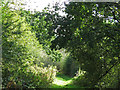
Farm Road, near Northwood
The footpath indcated by the sign to the right of the image is part of the London Loop long distance path.
Image: © Malc McDonald
Taken: 8 Sep 2013
0.10 miles
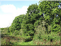
7
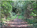
Footpath between Rickmansworth Road and Farm Road
Image: © Mike Quinn
Taken: 9 Oct 2019
0.11 miles
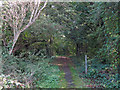
10
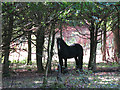
Horse in woodland between Rickmansworth Road and Farm Road
Image: © Mike Quinn
Taken: 9 Oct 2019
0.12 miles