IMAGES TAKEN NEAR TO
Badshot Lea Road, FARNHAM, GU9 9LR
Introduction
This page details the photographs taken nearby to Badshot Lea Road, GU9 9LR by members of the Geograph project.
The Geograph project started in 2005 with the aim of publishing, organising and preserving representative images for every square kilometre of Great Britain, Ireland and the Isle of Man.

There are currently over 7.5m images from over14,400 individuals and you can help contribute to the project by visiting https://www.geograph.org.uk
Image Map (Loading...)


Getting Data...Please wait
Leaflet Map data © OpenStreetMap
Images are licensed for reuse under creativecommons.org/licenses/by-sa/2.0
Notes
- Clicking on the map will re-center to the selected point.
- The higher the marker number, the further away the image location is from the centre of the postcode.
Image Listing (33 Images Found)
Images are licensed for reuse under creativecommons.org/licenses/by-sa/2.0
Image
Details
Distance
1
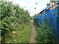
Part of Blackwater Valley Path
An unexciting stretch of public footpath forming a link in the route.
Image: © Robin Webster
Taken: 6 Aug 2015
0.06 miles
2
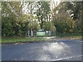
Entrance to Local Nature Reserve
A view of the entrance to Tice's Meadow Nature Reserve from the B3208 in Badshot Lea in Surrey.
Image: © John P Reeves
Taken: 22 Oct 2020
0.09 miles
3
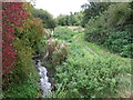
River Blackwater
The River Blackwater is very narrow at this point.
Image: © don cload
Taken: 4 Oct 2011
0.14 miles
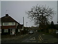
4
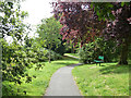
Part of Blackwater Valley Path
A pocket park near Pea Bridge.
Image: © Robin Webster
Taken: 6 Aug 2015
0.14 miles
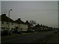
5
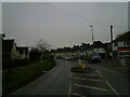
Badshot Lea
Looking north on the B3208 from near Pea Bridge.
Image: © Brendan and Ruth McCartney
Taken: 10 Jul 2011
0.15 miles
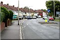
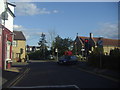
7
Looking from Boxall's Lane into Old Brickfield Road
Image: © Basher Eyre
Taken: 8 Dec 2022
0.18 miles
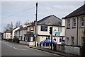
9
A gloomy lunchtime in Lower Farnham Road
Image: © Basher Eyre
Taken: 8 Dec 2022
0.19 miles
10
Lower Weybourne Lane at the junction of Badshot Lea Road
Image: © David Howard
Taken: 12 May 2012
0.20 miles