
IMAGES TAKEN NEAR TO
Staceys Farm Road, GODALMING, GU8 6EN
Introduction
This page details the photographs taken nearby to Staceys Farm Road, GU8 6EN by members of the Geograph project.
The Geograph project started in 2005 with the aim of publishing, organising and preserving representative images for every square kilometre of Great Britain, Ireland and the Isle of Man.

There are currently over 7.5m images from over14,400 individuals and you can help contribute to the project by visiting https://www.geograph.org.uk
Image Map
Images are licensed for reuse under creativecommons.org/licenses/by-sa/2.0
Notes
- Clicking on the map will re-center to the selected point.
- The higher the marker number, the further away the image location is from the centre of the postcode.
Image Listing (153 Images Found)
Images are licensed for reuse under creativecommons.org/licenses/by-sa/2.0
Image
Details
Distance
1
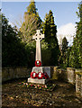
War Memorial, Thursley Road
The names on the front are of those who fell in WWI; the plaque beyond (just seen) has two names covering WWII to the present day. On the edge of the cemetery.
Image: © Peter Facey
Taken: 6 Dec 2009
0.04 miles
3

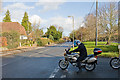
West Hill, Elstead
Not actually sure if this hill is named West Hill, but the housing at its foot (left) certainly is.
Image: © Peter Facey
Taken: 6 Dec 2009
0.06 miles
4
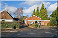
Village Hall and cinema, Thursley Road
The building on the right. The cinema was showing "A bunch of amateurs".
Image: © Peter Facey
Taken: 6 Dec 2009
0.06 miles
5
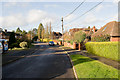
West Hill, Elstead
A residential cul de sac.
Image: © Peter Facey
Taken: 6 Dec 2009
0.06 miles
6
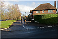
Stacey's Farm Road
Which runs parallel to Thursley Road. Seen looking across West Hill Road.
Image: © Peter Facey
Taken: 6 Dec 2009
0.07 miles
8
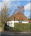
Youth Centre, Thursley Road
Also the HQ for the 7th Farnham Scout Group and Elstead Guides and Brownies. To its right is Image
Image: © Peter Facey
Taken: 6 Dec 2009
0.07 miles
9

Footpath approaching Thursley Road, Elstead
This footpath runs north from Ockley Common to Elstead. Here it descends quite a steeply between houses on the left and an electricity substation on the right into the centre of Elstead.
Image: © Peter Facey
Taken: 28 Nov 2009
0.07 miles
10
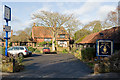
Royal British Legion branch, Elstead
There is a hall off-picture left which is available for hire.
Image: © Peter Facey
Taken: 28 Nov 2009
0.08 miles