IMAGES TAKEN NEAR TO
Roke Lane, GODALMING, GU8 5NX
Introduction
This page details the photographs taken nearby to Roke Lane, GU8 5NX by members of the Geograph project.
The Geograph project started in 2005 with the aim of publishing, organising and preserving representative images for every square kilometre of Great Britain, Ireland and the Isle of Man.

There are currently over 7.5m images from over14,400 individuals and you can help contribute to the project by visiting https://www.geograph.org.uk
Image Map (Loading...)


Getting Data...Please wait
Leaflet Map data © OpenStreetMap
Images are licensed for reuse under creativecommons.org/licenses/by-sa/2.0
Notes
- Clicking on the map will re-center to the selected point.
- The higher the marker number, the further away the image location is from the centre of the postcode.
Image Listing (53 Images Found)
Images are licensed for reuse under creativecommons.org/licenses/by-sa/2.0
Image
Details
Distance
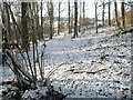
1
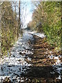
Footpath from Church Lane to Mare Hill (6)
Image: © Basher Eyre
Taken: 19 Dec 2009
0.03 miles
2
Footpath from Church Lane to Mare Hill (7)
Image: © Basher Eyre
Taken: 19 Dec 2009
0.04 miles
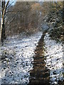
3
Footpath from Church Lane to Mare Hill (5)
Image: © Basher Eyre
Taken: 19 Dec 2009
0.04 miles
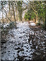
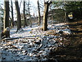
4
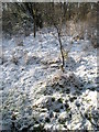
Snow still laying on the footpath from Church Lane to Mare Hill
Image: © Basher Eyre
Taken: 19 Dec 2009
0.05 miles

6
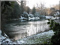
Partially frozen pond as seen on the footpath to Mare Hill
Image: © Basher Eyre
Taken: 19 Dec 2009
0.06 miles
7
View westwards from the path to Mare Hill
Image: © Basher Eyre
Taken: 19 Dec 2009
0.06 miles
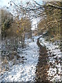
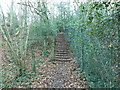
8
Footpath from Church Lane to Mare Hill (8)
Image: © Basher Eyre
Taken: 19 Dec 2009
0.06 miles
10
Approaching Mare Hill Cottages on the footpath from Church Lane
Image: © Basher Eyre
Taken: 19 Dec 2009
0.08 miles