
IMAGES TAKEN NEAR TO
Busdens Close, GODALMING, GU8 5JS
Introduction
This page details the photographs taken nearby to Busdens Close, GU8 5JS by members of the Geograph project.
The Geograph project started in 2005 with the aim of publishing, organising and preserving representative images for every square kilometre of Great Britain, Ireland and the Isle of Man.

There are currently over 7.5m images from over14,400 individuals and you can help contribute to the project by visiting https://www.geograph.org.uk
Image Map
Images are licensed for reuse under creativecommons.org/licenses/by-sa/2.0
Notes
- Clicking on the map will re-center to the selected point.
- The higher the marker number, the further away the image location is from the centre of the postcode.
Image Listing (61 Images Found)
Images are licensed for reuse under creativecommons.org/licenses/by-sa/2.0
Image
Details
Distance
1
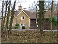
Stone Cottages, Petworth Road, Milford
Stone-built cottages is what they are, built of Bargate or similar Wealden stone - but Stone Cottages is also the address. The weather-boarded structure to the right is Hall Barn.
Seen across the A283 Petworth road from Milford Heath.
Image: © Stefan Czapski
Taken: 8 Mar 2012
0.13 miles
3

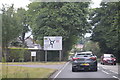
Blackhill Pond, Milford Heath
After a protracted period with little rainfall, the water level in the pond is low. The reedbed seems to consist chiefly of Lesser Bulrush (Lesser Reedmace), Typha angustifolia, a less common species than Great Reedmace, Typha latifolia.
The pond lies close to the A283 (just out of shot to the right).
Image: © Stefan Czapski
Taken: 8 Mar 2012
0.17 miles
6
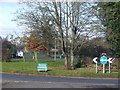
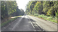
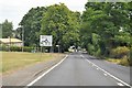
Roundabout, Milford
Large, grassy roundabout (with sponsor's sign) in south-west Milford where the routes from Haslemere and Petworth converge. Cheery Tree Road, leading to the Portsmouth Road, is in the background.
Image: © Colin Smith
Taken: 30 Jan 2011
0.21 miles
7
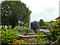
Milford - war memorial
By St. John's church on Church Road.
Image: © Robin Webster
Taken: 28 May 2012
0.23 miles
10
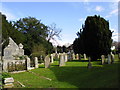
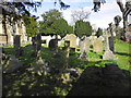
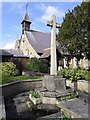
St John the Evangelist: churchyard (d)
Image: © Basher Eyre
Taken: 20 Apr 2012
0.23 miles