
IMAGES TAKEN NEAR TO
Petworth Road, GODALMING, GU8 5BY
Introduction
This page details the photographs taken nearby to Petworth Road, GU8 5BY by members of the Geograph project.
The Geograph project started in 2005 with the aim of publishing, organising and preserving representative images for every square kilometre of Great Britain, Ireland and the Isle of Man.

There are currently over 7.5m images from over14,400 individuals and you can help contribute to the project by visiting https://www.geograph.org.uk
Image Map
Images are licensed for reuse under creativecommons.org/licenses/by-sa/2.0
Notes
- Clicking on the map will re-center to the selected point.
- The higher the marker number, the further away the image location is from the centre of the postcode.
Image Listing (40 Images Found)
Images are licensed for reuse under creativecommons.org/licenses/by-sa/2.0
Image
Details
Distance
3
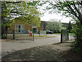
Witley - Rodborough Technology College
Taken from the A283.
Image: © Tony Bailey
Taken: 6 May 2006
0.06 miles
4
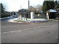
Junction of Oxted Green and Petworth Road
Image: © Basher Eyre
Taken: 19 Dec 2009
0.07 miles
5
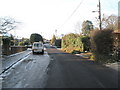
Still icy in places in Oxted Green
Just back from here I was striding along and then came down with a big thud.
Image: © Basher Eyre
Taken: 19 Dec 2009
0.07 miles
6
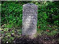
Old Milestone by the A283, Petworth Road, Godalming Parish
Carved stone post by the A283, in parish of GODALMING (WAVERLEY District), Petworth Road, junction with Oxted Green, Milford, in lay-by, between footpath and hedge, on East side of road. Petworth stone, erected by the Petworth turnpike trust in the 18th century.
Inscription reads:-
HYDE PARK CORNER
34 MILES
PETWORTH
13 MILES
GODALMING
2 MILES
CHIDDINGFOLD
4 MILES
Carved benchmark and rivet on crown of stone.
Milestone Society National ID: SY_LMP34.
Image: © HK Coleman
Taken: 20 Mar 2005
0.08 miles
8
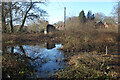
Pond on The Pleck
Shown on the map as access land, The Pleck is a tiny remnant of old woodland with a small pond in one corner.
Image: © Des Blenkinsopp
Taken: 6 Feb 2023
0.08 miles
10
Approaching the junction of Oxted Green and Martins Wood
Image: © Basher Eyre
Taken: 19 Dec 2009
0.12 miles