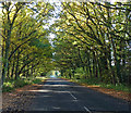
IMAGES TAKEN NEAR TO
Petworth Road, GODALMING, GU8 4SU

Introduction

This page details the photographs taken nearby to Petworth Road, GU8 4SU by members of the Geograph project.

The Geograph project started in 2005 with the aim of publishing, organising and preserving representative images for every square kilometre of Great Britain, Ireland and the Isle of Man.

There are currently over 7.5m images from over14,400 individuals and you can help contribute to the project by visiting https://www.geograph.org.uk

Image Map


Images are licensed for reuse under creativecommons.org/licenses/by-sa/2.0
Notes
  • Clicking on the map will re-center to the selected point.
  • The higher the marker number, the further away the image location is from the centre of the postcode.

Image Listing (6 Images Found)

Images are licensed for reuse under creativecommons.org/licenses/by-sa/2.0
Image
Details
Distance
1
Cripplecrutch Hill, Ramsnest Common
Image: © David Howard Taken: 26 Jun 2016
0.07 miles
2
A283 west of Stilland Farm
Image: © Stuart Logan Taken: 30 Oct 2012
0.13 miles
3
Broad Lane End Cottage, Fisherstreet
At a corner on the A283. The brickwork is the neat Flemish bond often found in this part of the Weald, with red stretchers and blue headers - see Image I like the barge-boards and pinnacles - which give the cottage the air of a Victorian signal-box.
Image: © Stefan Czapski Taken: 30 May 2012
0.15 miles
4
A283, northbound
Image: © N Chadwick Taken: 24 Jun 2017
0.16 miles
5
Sussex Border Path south to Dickhurst Great Copse
Image: © Dave Spicer Taken: 24 Jan 2010
0.21 miles
6
Shillinglee Road near Fisherstreet
Minor road heading for the A283 through a canopy of oaks.
Image: © Stephen Richards Taken: 13 Nov 2016
0.23 miles