IMAGES TAKEN NEAR TO
High Street Green, GODALMING, GU8 4DQ
Introduction
This page details the photographs taken nearby to High Street Green, GU8 4DQ by members of the Geograph project.
The Geograph project started in 2005 with the aim of publishing, organising and preserving representative images for every square kilometre of Great Britain, Ireland and the Isle of Man.

There are currently over 7.5m images from over14,400 individuals and you can help contribute to the project by visiting https://www.geograph.org.uk
Image Map
Images are licensed for reuse under creativecommons.org/licenses/by-sa/2.0
Notes
- Clicking on the map will re-center to the selected point.
- The higher the marker number, the further away the image location is from the centre of the postcode.
Image Listing (6 Images Found)
Images are licensed for reuse under creativecommons.org/licenses/by-sa/2.0
Image
Details
Distance
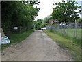
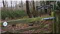
1
Bridleway approaching drive to Dunsfold Ryse
Image: © Dave Spicer
Taken: 12 Jun 2010
0.04 miles
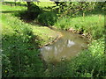
5
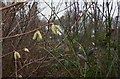
New and old
Catkins and seedpods in Lagfold Copse.
Image: © Shazz
Taken: 26 Jan 2009
0.23 miles