IMAGES TAKEN NEAR TO
Clock Barn Lane, GODALMING, GU8 4AZ
Introduction
This page details the photographs taken nearby to Clock Barn Lane, GU8 4AZ by members of the Geograph project.
The Geograph project started in 2005 with the aim of publishing, organising and preserving representative images for every square kilometre of Great Britain, Ireland and the Isle of Man.

There are currently over 7.5m images from over14,400 individuals and you can help contribute to the project by visiting https://www.geograph.org.uk
Image Map
Images are licensed for reuse under creativecommons.org/licenses/by-sa/2.0
Notes
- Clicking on the map will re-center to the selected point.
- The higher the marker number, the further away the image location is from the centre of the postcode.
Image Listing (9 Images Found)
Images are licensed for reuse under creativecommons.org/licenses/by-sa/2.0
Image
Details
Distance
1
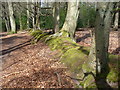
Woodland Bridleway, Busbridge
The bridleway follows an old boundary ridge through the woods.
Image: © Colin Smith
Taken: 18 Apr 2010
0.08 miles
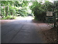
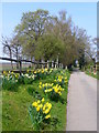
2
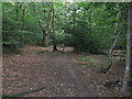
Bridleway SE in Home Wood to Clock Barn Lane
Image: © Dave Spicer
Taken: 24 Jul 2010
0.11 miles
3
Bridleway near Hydestile
Hard-surfaced bridleway heading into the woods south of Clock Barn Farm.
Image: © Colin Smith
Taken: 18 Apr 2010
0.13 miles
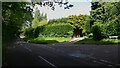
4
Junction of Hambledon Road with Clock Barn Lane, Busbridge
Hambledon Road is straight forward, and Clock Barn Lane to the left.
Image: © Humphrey Bolton
Taken: 1 Apr 2006
0.13 miles
5
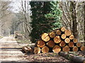
Busbridge Woods
Recent logging operations in Busbridge Wood, on Clock Barn Lane, are evident.
Image: © Colin Smith
Taken: 18 Apr 2010
0.16 miles
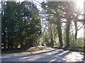
6
Hambledon Road looking north
To the right is Clock Barn Lane and ahead to the left is the entrance to Clock Barn Farm.
Image: © Shazz
Taken: 21 May 2009
0.16 miles
7
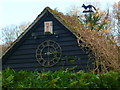
The barn clock at Clock Barn Farm
There's also a foxy weather vane.
Image: © Shazz
Taken: 10 Dec 2012
0.18 miles
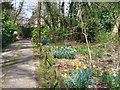
9
Bridleway to Clock Barn Farm
The bridleway here follows the hard-surfaced farm road before it turns sandy.
Image: © Colin Smith
Taken: 18 Apr 2010
0.19 miles