
IMAGES TAKEN NEAR TO
Greensand Place, GODALMING, GU7 3FH
Introduction
This page details the photographs taken nearby to Greensand Place, GU7 3FH by members of the Geograph project.
The Geograph project started in 2005 with the aim of publishing, organising and preserving representative images for every square kilometre of Great Britain, Ireland and the Isle of Man.

There are currently over 7.5m images from over14,400 individuals and you can help contribute to the project by visiting https://www.geograph.org.uk
Image Map
Images are licensed for reuse under creativecommons.org/licenses/by-sa/2.0
Notes
- Clicking on the map will re-center to the selected point.
- The higher the marker number, the further away the image location is from the centre of the postcode.
Image Listing (16 Images Found)
Images are licensed for reuse under creativecommons.org/licenses/by-sa/2.0
Image
Details
Distance
1

Birch Road, Farncombe.
Bungalow suburbia, ideal retirement ground in Surrey.
Image: © Colin Smith
Taken: Unknown
0.08 miles
3
New Pond Road
The B3000 approaching the turning for Stakescorner Road (right), followed by Furze Lane on the left into Farncombe.
Image: © Derek Harper
Taken: 17 Sep 2018
0.13 miles
4
Turning for Brethren chapel off New Pond Road
Image: © David Smith
Taken: 21 Nov 2012
0.13 miles
5
Restricted access to Stakescorner Road
A potential through route towards Guildford is denied.
Image: © Robin Webster
Taken: 9 Nov 2011
0.14 miles
6
Fields and buildings by New Pond Road, Binscombe
Image: © David Howard
Taken: 29 Aug 2011
0.14 miles
7
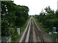
View from the footbridge 2
Looking north-east towards Guildford and London.
Image: © Jonathan Billinger
Taken: 31 May 2008
0.20 miles
8

Summer's Close
Road next to Broadwater School playing fields.
Image: © James Emmans
Taken: 23 Jan 2021
0.20 miles
9

Field north of Farncombe, from the railway
Image: © Christopher Hilton
Taken: 19 May 2025
0.22 miles
10
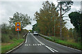
B3000 ramps up to cross the railway
The railway and road approach each other at about the same elevation. Many railways would have used a level crossing in these circumstances, but this bridge seems to have been there since the beginning, or at least 1879.
Image: © Robin Webster
Taken: 9 Nov 2011
0.22 miles