IMAGES TAKEN NEAR TO
Coopers Rise, GODALMING, GU7 2NH
Introduction
This page details the photographs taken nearby to Coopers Rise, GU7 2NH by members of the Geograph project.
The Geograph project started in 2005 with the aim of publishing, organising and preserving representative images for every square kilometre of Great Britain, Ireland and the Isle of Man.

There are currently over 7.5m images from over14,400 individuals and you can help contribute to the project by visiting https://www.geograph.org.uk
Image Map
Images are licensed for reuse under creativecommons.org/licenses/by-sa/2.0
Notes
- Clicking on the map will re-center to the selected point.
- The higher the marker number, the further away the image location is from the centre of the postcode.
Image Listing (31 Images Found)
Images are licensed for reuse under creativecommons.org/licenses/by-sa/2.0
Image
Details
Distance
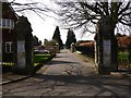
1
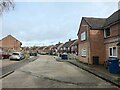
Ockford Ridge - Coopers Rise
Housing estate with some new housing redevelopments and new roads.
Image: © James Emmans
Taken: 12 Mar 2021
0.04 miles
3
2016: a year on Geograph (Day 323)
Looking from Franklyn Road into Seymour Road
Image: © Basher Eyre
Taken: 18 Nov 2016
0.12 miles
4
2016: a year on Geograph (Day 321)
Junction of Seymour and Franklyn Roads
Image: © Basher Eyre
Taken: 16 Nov 2016
0.14 miles
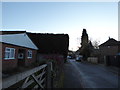
5
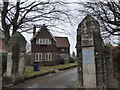
2016: a year on Geograph (Day 344)
Cemetery Lodge, opposite the boundary between Ockford Ridge and Franklyn Road
Image: © Basher Eyre
Taken: 9 Dec 2016
0.15 miles
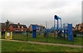
8
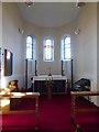
2016: a year on Geograph (Day 337)
Inside St Mark, Godalming http://www.parishofgodalming.org.uk/our-church-of-st-marks/
Image: © Basher Eyre
Taken: 2 Dec 2016
0.17 miles
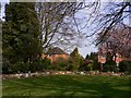
9
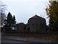
2016: a year on Geograph (Day 319)
St Mark's Community Church and Centre http://www.parishofgodalming.org.uk/our-church-of-st-marks/
Image: © Basher Eyre
Taken: 14 Nov 2016
0.18 miles
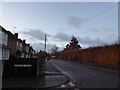
10
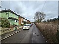
Ockford Ridge - Cliffe Road
Road next to a tributary of the River Wey and the main line Railway.
The London to Cosham line was opened in 1848 by the LSWR.
Wikipedia page : https://en.wikipedia.org/wiki/London_and_South_Western_Railway
Image: © James Emmans
Taken: 12 Mar 2021
0.18 miles