
IMAGES TAKEN NEAR TO
Bargate Rise, GODALMING, GU7 2NA
Introduction
This page details the photographs taken nearby to Bargate Rise, GU7 2NA by members of the Geograph project.
The Geograph project started in 2005 with the aim of publishing, organising and preserving representative images for every square kilometre of Great Britain, Ireland and the Isle of Man.

There are currently over 7.5m images from over14,400 individuals and you can help contribute to the project by visiting https://www.geograph.org.uk
Image Map
Images are licensed for reuse under creativecommons.org/licenses/by-sa/2.0
Notes
- Clicking on the map will re-center to the selected point.
- The higher the marker number, the further away the image location is from the centre of the postcode.
Image Listing (17 Images Found)
Images are licensed for reuse under creativecommons.org/licenses/by-sa/2.0
Image
Details
Distance
1
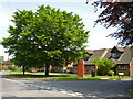
Phone box, corner of Aarons Hill and Bargate Rise
Image: © Robin Webster
Taken: 28 May 2012
0.02 miles
2
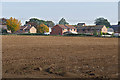
Aaron's Hill, Godalming
The view from Halfway Lane towards Aaron's Hill, a housing estate to the west of Godalming.
Image: © Alan Hunt
Taken: 11 Oct 2015
0.12 miles
3
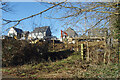
New Houses, Carex Close
Like most other towns, the outskirts of Godalming are currently a huge building site.
I am guessing that the street name Carex refers to the large plant family to which sedges belong rather than the hand sanitizer brand which has the same name.
Image: © Des Blenkinsopp
Taken: 6 Feb 2023
0.14 miles
4
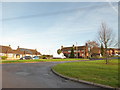
2016: a year on Geograph (Day 316)
Aaron's Hill
Image: © Basher Eyre
Taken: 11 Nov 2016
0.15 miles
5
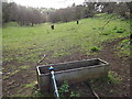
Dry Valley by the New Way
Water trough at the head of a dry valley between Aaron's Hill and Westbrook on the edge of Godalming.
http://www.godalming-tc.gov.uk/
Image: © Colin Smith
Taken: 10 Apr 2012
0.15 miles
6
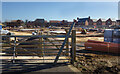
The other side of Halfway Lane
This is what's over the road from the quiet looking country lane pictured in Image
Image: © Des Blenkinsopp
Taken: 6 Feb 2023
0.19 miles
7
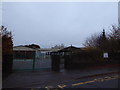
2016: a year on Geograph (Day 320)
Green Oak Primary School, Franklyn Road
Image: © Basher Eyre
Taken: 15 Nov 2016
0.22 miles
8
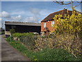
Half Measures
Tile-hung Halfway House on Halfway Lane close to Upper Eashing.
Image: © Colin Smith
Taken: 10 Apr 2012
0.22 miles
9
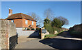
Halfway House, Halfway Lane
A seemingly peaceful picture of a rural cottage down a country lane.
Not so. The other side of the road is a huge building site and this place will soon be surrounded by the 21st century.
Image: © Des Blenkinsopp
Taken: 6 Feb 2023
0.22 miles
10
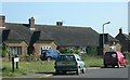
Aaron's Hill
Aaron's Hill near Godalming.
Image: © Ben Gamble
Taken: 18 Jun 2005
0.22 miles