
IMAGES TAKEN NEAR TO
The Close, GODALMING, GU7 1PQ
Introduction
This page details the photographs taken nearby to The Close, GU7 1PQ by members of the Geograph project.
The Geograph project started in 2005 with the aim of publishing, organising and preserving representative images for every square kilometre of Great Britain, Ireland and the Isle of Man.

There are currently over 7.5m images from over14,400 individuals and you can help contribute to the project by visiting https://www.geograph.org.uk
Image Map
Images are licensed for reuse under creativecommons.org/licenses/by-sa/2.0
Notes
- Clicking on the map will re-center to the selected point.
- The higher the marker number, the further away the image location is from the centre of the postcode.
Image Listing (113 Images Found)
Images are licensed for reuse under creativecommons.org/licenses/by-sa/2.0
Image
Details
Distance
1
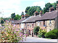
Brighton Road
Victorian terrace of brick houses in Crownpits, south Godalming. Crownpits comes from an Old English word, crumb = crooked. The road is crooked, sharp bends.
Image: © Colin Smith
Taken: 27 Jun 2009
0.07 miles
2
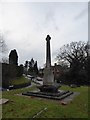
Busbridge War Memorial: early February 2017
Image: © Basher Eyre
Taken: 2 Feb 2017
0.12 miles
4
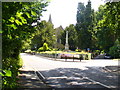
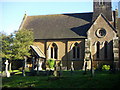
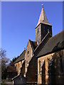
Brighton Road, Busbridge
The parish church sits in the fork between Brighton and Hambledon Roads.
http://busbridgechurch.org/
Image: © Colin Smith
Taken: 27 Jun 2009
0.12 miles
8
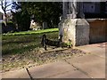
Boot and shoe scraper at porch of Busbridge church
Image: © Shazz
Taken: 7 Mar 2011
0.12 miles
9

St John the Baptist, Busbridge: stained glass window (v)
Image: © Basher Eyre
Taken: 2 Feb 2017
0.12 miles
10
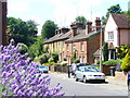
Brighton Road, Crownpits
A splash of colour from lavender brightens up this bending road with its terraced cottages between Godalming and Busbridge.
Image: © Colin Smith
Taken: 27 Jun 2009
0.12 miles