IMAGES TAKEN NEAR TO
Loxford Court, CRANLEIGH, GU6 8TG
Introduction
This page details the photographs taken nearby to Loxford Court, GU6 8TG by members of the Geograph project.
The Geograph project started in 2005 with the aim of publishing, organising and preserving representative images for every square kilometre of Great Britain, Ireland and the Isle of Man.

There are currently over 7.5m images from over14,400 individuals and you can help contribute to the project by visiting https://www.geograph.org.uk
Image Map
Images are licensed for reuse under creativecommons.org/licenses/by-sa/2.0
Notes
- Clicking on the map will re-center to the selected point.
- The higher the marker number, the further away the image location is from the centre of the postcode.
Image Listing (37 Images Found)
Images are licensed for reuse under creativecommons.org/licenses/by-sa/2.0
Image
Details
Distance
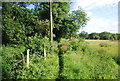
4
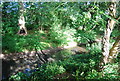
Overgrown Wey and Arun Canal
To the left of the canal is Elmbridge Village a new housing estate west of Cranleigh.
Image: © Dave Spicer
Taken: 5 Nov 2011
0.07 miles
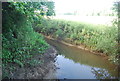

8
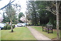
Pheasant on footbridge rail on the Wey South Path
Image: © Dave Spicer
Taken: 5 Nov 2011
0.10 miles
9
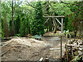
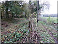
Course of Wey and Arun Junction Canal
A section of canal south of Elmbridge Road that is filled in, and here being used for some sort of logging enterprise.
Image: © Robin Webster
Taken: 7 Jun 2011
0.11 miles
