IMAGES TAKEN NEAR TO
Smithwood Common, CRANLEIGH, GU6 8QX
Introduction
This page details the photographs taken nearby to Smithwood Common, GU6 8QX by members of the Geograph project.
The Geograph project started in 2005 with the aim of publishing, organising and preserving representative images for every square kilometre of Great Britain, Ireland and the Isle of Man.

There are currently over 7.5m images from over14,400 individuals and you can help contribute to the project by visiting https://www.geograph.org.uk
Image Map (Loading...)


Getting Data...Please wait
Leaflet Map data © OpenStreetMap
Images are licensed for reuse under creativecommons.org/licenses/by-sa/2.0
Notes
- Clicking on the map will re-center to the selected point.
- The higher the marker number, the further away the image location is from the centre of the postcode.
Image Listing (22 Images Found)
Images are licensed for reuse under creativecommons.org/licenses/by-sa/2.0
Image
Details
Distance
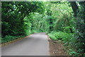

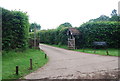
5
Track off Alderbrook Rd
The track crosses Smithwood Common.
Image: © N Chadwick
Taken: 10 Jun 2012
0.12 miles

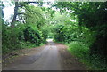
9
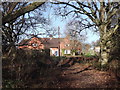
Footpath Near Pittance Farm
Wide woodland path with fairly good going after a couple of days of rain.
Image: © Colin Smith
Taken: 27 Jan 2012
0.13 miles
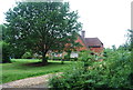
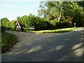
10
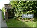
Seating provided at Lapscombe Farm entrance
Two footpaths leave the road here.
Image: © Shazz
Taken: 23 Sep 2011
0.13 miles