IMAGES TAKEN NEAR TO
Guildford Road, CRANLEIGH, GU6 8LT
Introduction
This page details the photographs taken nearby to Guildford Road, GU6 8LT by members of the Geograph project.
The Geograph project started in 2005 with the aim of publishing, organising and preserving representative images for every square kilometre of Great Britain, Ireland and the Isle of Man.

There are currently over 7.5m images from over14,400 individuals and you can help contribute to the project by visiting https://www.geograph.org.uk
Image Map
Images are licensed for reuse under creativecommons.org/licenses/by-sa/2.0
Notes
- Clicking on the map will re-center to the selected point.
- The higher the marker number, the further away the image location is from the centre of the postcode.
Image Listing (14 Images Found)
Images are licensed for reuse under creativecommons.org/licenses/by-sa/2.0
Image
Details
Distance
1
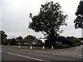
Notcutts Garden Centre on Guildford Road
Image: © David Howard
Taken: 3 Aug 2015
0.11 miles
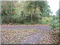
2
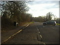
Guildford Road entering Cranleigh
At the entrance to Norther farm on the right. The bin at the bus stop appears a recent addition as not on Google.
Image: © David Howard
Taken: 26 Feb 2012
0.11 miles
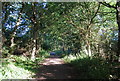
4
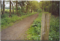
Downslink Milepost.
The wooden post says 1 mile to Cranleigh but still 25.5 miles to go before walkers reach the South Downs Way. The path here has a good surface as it follows the former Guildford - Cranleigh railway line.
Image: © Colin Smith
Taken: 7 May 2006
0.21 miles
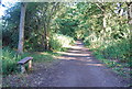
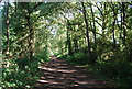
6
Path junction on the Downs Link
South of Ruffold Farm.
Image: © Dave Spicer
Taken: 5 Nov 2011
0.22 miles