IMAGES TAKEN NEAR TO
Willow Close, CRANLEIGH, GU6 8FA
Introduction
This page details the photographs taken nearby to Willow Close, GU6 8FA by members of the Geograph project.
The Geograph project started in 2005 with the aim of publishing, organising and preserving representative images for every square kilometre of Great Britain, Ireland and the Isle of Man.

There are currently over 7.5m images from over14,400 individuals and you can help contribute to the project by visiting https://www.geograph.org.uk
Image Map
Images are licensed for reuse under creativecommons.org/licenses/by-sa/2.0
Notes
- Clicking on the map will re-center to the selected point.
- The higher the marker number, the further away the image location is from the centre of the postcode.
Image Listing (20 Images Found)
Images are licensed for reuse under creativecommons.org/licenses/by-sa/2.0
Image
Details
Distance
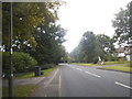
6
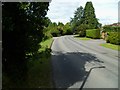
Bend on Horsham Road in Cranleigh
This is the B2128.
Image: © Shazz
Taken: 29 Aug 2011
0.16 miles
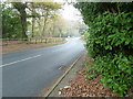
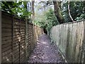
8
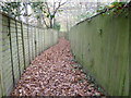
Enclosed footpath off the B2128
The path leads to Rowgardens Copse.
Image: © Dave Spicer
Taken: 20 Nov 2011
0.17 miles
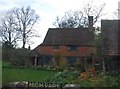
9
Enclosed path
An enclosed footpath just beyond the Horsham Road.
Image: © Chris Thomas-Atkin
Taken: 14 Apr 2019
0.18 miles
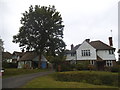
10
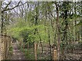
Rowgardens Copse
On the public footpath passing Rowgardens Copse.
Image: © Chris Thomas-Atkin
Taken: 14 Apr 2019
0.18 miles