IMAGES TAKEN NEAR TO
Bloxham Road, CRANLEIGH, GU6 7EY
Introduction
This page details the photographs taken nearby to Bloxham Road, GU6 7EY by members of the Geograph project.
The Geograph project started in 2005 with the aim of publishing, organising and preserving representative images for every square kilometre of Great Britain, Ireland and the Isle of Man.

There are currently over 7.5m images from over14,400 individuals and you can help contribute to the project by visiting https://www.geograph.org.uk
Image Map
Images are licensed for reuse under creativecommons.org/licenses/by-sa/2.0
Notes
- Clicking on the map will re-center to the selected point.
- The higher the marker number, the further away the image location is from the centre of the postcode.
Image Listing (17 Images Found)
Images are licensed for reuse under creativecommons.org/licenses/by-sa/2.0
Image
Details
Distance
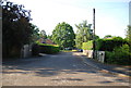
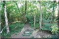
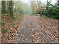
6
Footpath and bridleway intersection
At the western edge of Book Hurst.
Image: © Dave Spicer
Taken: 20 Nov 2011
0.15 miles
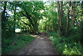
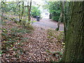
7
In Book Hurst
Cranleigh footpath 368 threads its way through the woods.
Image: © Robin Webster
Taken: 9 Jun 2011
0.16 miles
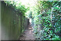
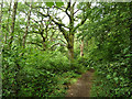
8
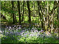
Book Hurst
Coppicing and bluebells in the deciduous woodland east of Cranleigh.
Image: © Colin Smith
Taken: 15 May 2010
0.18 miles
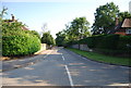
9
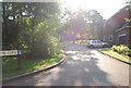
Bridleway and drive to Wanborough House
Image: © Dave Spicer
Taken: 20 Nov 2011
0.19 miles