IMAGES TAKEN NEAR TO
Ewhurst Road, CRANLEIGH, GU6 7EA
Introduction
This page details the photographs taken nearby to Ewhurst Road, GU6 7EA by members of the Geograph project.
The Geograph project started in 2005 with the aim of publishing, organising and preserving representative images for every square kilometre of Great Britain, Ireland and the Isle of Man.

There are currently over 7.5m images from over14,400 individuals and you can help contribute to the project by visiting https://www.geograph.org.uk
Image Map
Images are licensed for reuse under creativecommons.org/licenses/by-sa/2.0
Notes
- Clicking on the map will re-center to the selected point.
- The higher the marker number, the further away the image location is from the centre of the postcode.
Image Listing (255 Images Found)
Images are licensed for reuse under creativecommons.org/licenses/by-sa/2.0
Image
Details
Distance
2
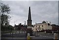
Obelisk, Cranleigh
An interesting way of displaying road signs.
Image: © N Chadwick
Taken: 2 May 2010
0.02 miles
6
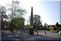
Obelisk in Cranleigh
Grade II listed. http://www.britishlistedbuildings.co.uk/en-291713-obelisk-cranleigh
Image: © N Chadwick
Taken: 3 Jul 2011
0.03 miles
7

Old Milestone by the B2128, High Street, Cranleigh
Metal plates attached to stone post by the B2128, in parish of CRANLEIGH (WAVERLEY District), High Street junction with Ewhurst Road and Horsham Road, on triangular island at village centre. Cranleigh limestone obelisk, erected by the Bramley & Rudgewick turnpike trust in the 18th century.
Inscription reads:-
: RUDGWICK 5 / HORSHAM 10 / BRIGHTON 31 : : WONERSH 5 / GUILDFORD 8 / WINDSOR 31 : : EWHURST 2 / OCKLEY 6 / DORKING 12 :
Maker:-
: J CHAMPION, Cranleigh :
Grade II listed.
List Entry Number: 1352783 https://historicengland.org.uk/listing/the-list/list-entry/1352783
Milestone Society National ID: SY_CRANOB.
Image: © L Joseph
Taken: 1 Mar 2005
0.03 miles
8

Old Milestone by the B2128, High Street, Cranleigh
Metal plates attached to stone post by the B2128, in parish of CRANLEIGH (WAVERLEY District), High Street junction with Ewhurst Road and Horsham Road, on triangular island at village centre. Cranleigh limestone obelisk, erected by the Bramley & Rudgewick turnpike trust in the 18th century.
Inscription reads:-
: RUDGWICK 5 / HORSHAM 10 / BRIGHTON 31 : : WONERSH 5 / GUILDFORD 8 / WINDSOR 31 : : EWHURST 2 / OCKLEY 6 / DORKING 12 :
Maker:-
: J CHAMPION, Cranleigh :
Grade II listed.
List Entry Number: 1352783 https://web.archive.org/web/20200815073005/https://historicengland.org.uk/listing/the-list/list-entry/1352783
Milestone Society National ID: SY_CRANOB.
Image: © Chris Gale
Taken: 27 Jul 2025
0.03 miles