IMAGES TAKEN NEAR TO
Copse Edge, CRANLEIGH, GU6 7DU
Introduction
This page details the photographs taken nearby to Copse Edge, GU6 7DU by members of the Geograph project.
The Geograph project started in 2005 with the aim of publishing, organising and preserving representative images for every square kilometre of Great Britain, Ireland and the Isle of Man.

There are currently over 7.5m images from over14,400 individuals and you can help contribute to the project by visiting https://www.geograph.org.uk
Image Map
Images are licensed for reuse under creativecommons.org/licenses/by-sa/2.0
Notes
- Clicking on the map will re-center to the selected point.
- The higher the marker number, the further away the image location is from the centre of the postcode.
Image Listing (40 Images Found)
Images are licensed for reuse under creativecommons.org/licenses/by-sa/2.0
Image
Details
Distance
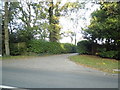
2
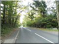
Barhatch Road leaving Cranleigh
Heading north towards Shere and the A25
Image: © David Howard
Taken: 14 Sep 2014
0.08 miles
3
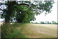
Hedge along the edge of a field near Cranleigh
Image: © N Chadwick
Taken: 4 Jul 2010
0.09 miles
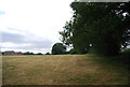
5
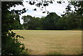
Footpath south to Cranleigh
The northern outskirts can just be seen in the trees.
Image: © N Chadwick
Taken: 4 Jul 2010
0.14 miles
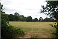
6
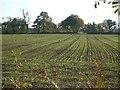
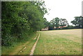
Field south of Amlets Lane
looking south
Image: © Andrew Longton
Taken: 27 Oct 2005
0.15 miles
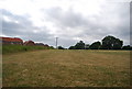
7
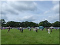
A wonderful day at the Cranleigh Show (4)
Image: © Basher Eyre
Taken: 19 Jun 2016
0.16 miles