
IMAGES TAKEN NEAR TO
Jesses Lane, GUILDFORD, GU5 9RT
Introduction
This page details the photographs taken nearby to Jesses Lane, GU5 9RT by members of the Geograph project.
The Geograph project started in 2005 with the aim of publishing, organising and preserving representative images for every square kilometre of Great Britain, Ireland and the Isle of Man.

There are currently over 7.5m images from over14,400 individuals and you can help contribute to the project by visiting https://www.geograph.org.uk
Image Map
Images are licensed for reuse under creativecommons.org/licenses/by-sa/2.0
Notes
- Clicking on the map will re-center to the selected point.
- The higher the marker number, the further away the image location is from the centre of the postcode.
Image Listing (8 Images Found)
Images are licensed for reuse under creativecommons.org/licenses/by-sa/2.0
Image
Details
Distance
1
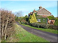
Jesses Lane
Cottages and hedgerows line this country lane north of Peaslake.
Image: © Colin Smith
Taken: 12 Jan 2008
0.02 miles
2
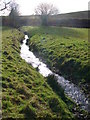
Surrey Hills Stream
Shallow brook descending a grassy hillside north of Peaslake. It will join the Tilling Bourne.
Image: © Colin Smith
Taken: 12 Jan 2008
0.06 miles
3
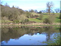
Pond by Lawbrook
Bare winter vegetation and grassy hillsides surround this small pond in the Surrey Hills near Peaslake.
Image: © Colin Smith
Taken: 12 Jan 2008
0.12 miles
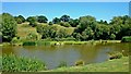
5
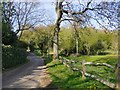
Lawbrook Lane
The dip about 50m ahead is the point where the lane crosses the brook.
Image: © Stefan Czapski
Taken: 20 Apr 2015
0.16 miles
6
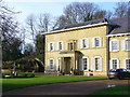
Lawbrook
Eyecatching mansion with fountain and large grounds near Peaslake, in Surrey's stockbroker belt.
Image: © Colin Smith
Taken: 12 Jan 2008
0.18 miles
7
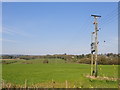
View from Lane End Farm
View roughly north-east, towards Oak Farm and Jesses Lane.
Image: © Stefan Czapski
Taken: 20 Apr 2015
0.20 miles
8
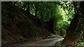
Lawbrook Lane
An ancient lane, with the road surface now running through a cutting.
Image: © Peter Trimming
Taken: 29 Sep 2019
0.21 miles