IMAGES TAKEN NEAR TO
Shophouse Lane, GUILDFORD, GU5 9EG
Introduction
This page details the photographs taken nearby to Shophouse Lane, GU5 9EG by members of the Geograph project.
The Geograph project started in 2005 with the aim of publishing, organising and preserving representative images for every square kilometre of Great Britain, Ireland and the Isle of Man.

There are currently over 7.5m images from over14,400 individuals and you can help contribute to the project by visiting https://www.geograph.org.uk
Image Map
Images are licensed for reuse under creativecommons.org/licenses/by-sa/2.0
Notes
- Clicking on the map will re-center to the selected point.
- The higher the marker number, the further away the image location is from the centre of the postcode.
Image Listing (66 Images Found)
Images are licensed for reuse under creativecommons.org/licenses/by-sa/2.0
Image
Details
Distance
3
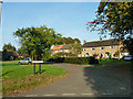
Kingsfield, Farley Green
A small close of houses and bungalows.
Image: © Robin Webster
Taken: 23 Oct 2011
0.04 miles
4
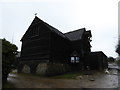
St Michael's Barn Church, Farley Green: mid February 2017
Image: © Basher Eyre
Taken: 15 Feb 2017
0.05 miles
5

Tillingbourne bus at Farley Green ? 1972
Taken shortly after new management was brought in to run what had been for many years a family business. The company ran a small number of local services among the villages associated with the valley of the Tilling Bourne, and Farley Green was one of the terminal points, where Kingsfield provided a convenient turning loop. The location was little changed in 2011 https://www.geograph.org.uk/photo/2661764 .
The bus is a Bristol LS with ECW bodywork, built originally as a touring/express coach in 1954 for the South Wales operator Red & White Services. It had joined the Tillingbourne fleet a few months earlier.
This is one of a series of views featuring buses in the 60s, 70s, and 80s.
http://www.geograph.org.uk/search.php?i=2114547&displayclass=slide
Image: © Alan Murray-Rust
Taken: 24 Jun 1972
0.05 miles
6
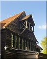
Belfry and gable, Farley Green church
If as you approach along the lane you don't see the bell, you could mistake the belfry for a hoist - and the church for the barn it once was.
Image: © Stefan Czapski
Taken: 16 May 2015
0.05 miles
7
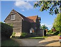
Farley Green church
St Michael's, Farley Green - converted from a weather-boarded barn and backing on to a farmyard and farm out-buildings in similar style. The site is quite tucked away - I had passed by along Shophouse Lane a number of times without being aware of the church's existence. On this occasion I happened to notice the little cross marked on the map, and decided to investigate. I was half-expecting to find a 'tin tabernacle' (not unknown in Surrey) - but finding a 'timber tabernacle' was a real surprise.
Image: © Stefan Czapski
Taken: 16 May 2015
0.05 miles
8
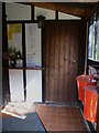
The porch of Farley Green church
The main body of the church was locked.
Image: © Shazz
Taken: 13 Sep 2011
0.05 miles
9
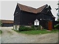
Farley Green church with farmyard beyond
The church is a converted 19th century barn. The main body of the building was locked but for the interior of the porch see Image
Image: © Shazz
Taken: 13 Sep 2011
0.05 miles