IMAGES TAKEN NEAR TO
Highfield Grange, GUILDFORD, GU5 9DT
Introduction
This page details the photographs taken nearby to Highfield Grange, GU5 9DT by members of the Geograph project.
The Geograph project started in 2005 with the aim of publishing, organising and preserving representative images for every square kilometre of Great Britain, Ireland and the Isle of Man.

There are currently over 7.5m images from over14,400 individuals and you can help contribute to the project by visiting https://www.geograph.org.uk
Image Map
Images are licensed for reuse under creativecommons.org/licenses/by-sa/2.0
Notes
- Clicking on the map will re-center to the selected point.
- The higher the marker number, the further away the image location is from the centre of the postcode.
Image Listing (14 Images Found)
Images are licensed for reuse under creativecommons.org/licenses/by-sa/2.0
Image
Details
Distance
1
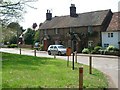
Hoe
A hamlet between Peaslake and Sutton Abinger
Image: © Andrew Longton
Taken: 4 May 2006
0.12 miles
2
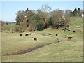
Grazing Cattle
Looking West from the start of Broadfield Road (really an unmetalled track)
Image: © Martyn Davies
Taken: 6 Apr 2006
0.12 miles
3
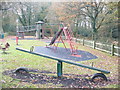
Ho, Ho, Ho, Hoe
Children's playpark south of Hoe, conveniently sited close to the primary school at Peaslake.
Image: © Colin Smith
Taken: 20 Dec 2011
0.13 miles
4
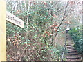
Step This Way, Peaslake
The footpath from Peaslake Lane leads up the steps to a grassy hilltop and a children's playpark.
Image: © Colin Smith
Taken: 20 Dec 2011
0.14 miles
5
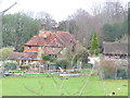
Hoe Farm
Large farm in the Surrey Hills hamlet of Hoe, near Peaslake.
Image: © Colin Smith
Taken: 20 Dec 2011
0.16 miles
6
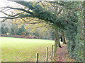
Path near Hoe Farm
Following the side of a grassy field in the hamlet of Hoe.
Image: © Colin Smith
Taken: 20 Dec 2011
0.18 miles
7
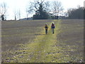
Footpath to Peaslake
Walking in the Surrey Hills around Peaslake is a popular pastime. The going here is good over the sandy ridge.
Image: © Colin Smith
Taken: 12 Jan 2008
0.19 miles
8
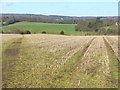
Footpath from Peaslake
Heading north over the sandy ridge from Pond Lane. Old stubbly drills cover the sandy ridge.
Image: © Colin Smith
Taken: 12 Jan 2008
0.20 miles
9
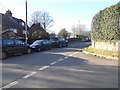
Junction on Hoe Lane, Peaslake
Hoe Lane is one of those annoying Y shaped roads where it's almost impossible for traffic and delivery people to navigate as it's named on more than a single stretch of road.
Image: © David Howard
Taken: 17 Apr 2016
0.20 miles
10
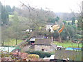
Mackies Hill, Peaslake
View from the grassy hilltop towards the houses in the valley below.
Image: © Colin Smith
Taken: 20 Dec 2011
0.20 miles