
IMAGES TAKEN NEAR TO
Guildford Lane, GUILDFORD, GU5 9BG
Introduction
This page details the photographs taken nearby to Guildford Lane, GU5 9BG by members of the Geograph project.
The Geograph project started in 2005 with the aim of publishing, organising and preserving representative images for every square kilometre of Great Britain, Ireland and the Isle of Man.

There are currently over 7.5m images from over14,400 individuals and you can help contribute to the project by visiting https://www.geograph.org.uk
Image Map
Images are licensed for reuse under creativecommons.org/licenses/by-sa/2.0
Notes
- Clicking on the map will re-center to the selected point.
- The higher the marker number, the further away the image location is from the centre of the postcode.
Image Listing (62 Images Found)
Images are licensed for reuse under creativecommons.org/licenses/by-sa/2.0
Image
Details
Distance

4
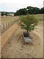
Where has the water gone?
The footpath has turned to sand, the ground is parched and there is no water in the trough. The tree seems to be surviving though!
Image: © don cload
Taken: 20 Jul 2010
0.10 miles

7
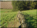
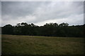
Fence near Newbarn
A fence line running down the field between the Pilgrims Way and the western end of the small wood near Newbarn.
Image: © Alan Hunt
Taken: 11 Oct 2014
0.12 miles
9
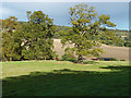
Tree line, Albury Downs
A tree line between the Pilgrims Way and the small wood by Newbarn with newlands Corner in the background.
Image: © Alan Hunt
Taken: 11 Oct 2014
0.13 miles
10
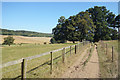
The Pilgrims' Way (allegedly)
There must be some evidence that this is indeed an ancient trackway for it to be shown in antique script on the map. However, it's far from continuous, with the name coming and going at intervals. About 1 km beyond here it becomes very unconvincing.
Image: © Des Blenkinsopp
Taken: 19 Sep 2019
0.13 miles