IMAGES TAKEN NEAR TO
Oakwood, FLEET, GU52 8BY
Introduction
This page details the photographs taken nearby to Oakwood, GU52 8BY by members of the Geograph project.
The Geograph project started in 2005 with the aim of publishing, organising and preserving representative images for every square kilometre of Great Britain, Ireland and the Isle of Man.

There are currently over 7.5m images from over14,400 individuals and you can help contribute to the project by visiting https://www.geograph.org.uk
Image Map
Images are licensed for reuse under creativecommons.org/licenses/by-sa/2.0
Notes
- Clicking on the map will re-center to the selected point.
- The higher the marker number, the further away the image location is from the centre of the postcode.
Image Listing (21 Images Found)
Images are licensed for reuse under creativecommons.org/licenses/by-sa/2.0
Image
Details
Distance
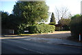
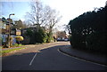
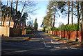
2
Sandy Lane, Church Crookham
Looking west.
Image: © Robin Webster
Taken: 18 Jul 2021
0.12 miles
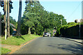
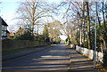
4
Urban Church Crookham
Attractive trees, unattractive recycling bins.
Image: © David Medcalf
Taken: 5 May 2006
0.13 miles
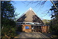
6
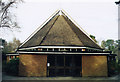
Holy Trinity, Church Crookham
Built in 1968.
Image: © Michael FORD
Taken: Unknown
0.14 miles
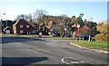
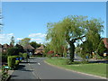
10
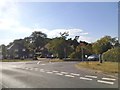
The Verne at the junction of Aldershot Road
Image: © David Howard
Taken: 14 Aug 2016
0.17 miles