IMAGES TAKEN NEAR TO
Gorseway, FLEET, GU52 7NA
Introduction
This page details the photographs taken nearby to Gorseway, GU52 7NA by members of the Geograph project.
The Geograph project started in 2005 with the aim of publishing, organising and preserving representative images for every square kilometre of Great Britain, Ireland and the Isle of Man.

There are currently over 7.5m images from over14,400 individuals and you can help contribute to the project by visiting https://www.geograph.org.uk
Image Map
Images are licensed for reuse under creativecommons.org/licenses/by-sa/2.0
Notes
- Clicking on the map will re-center to the selected point.
- The higher the marker number, the further away the image location is from the centre of the postcode.
Image Listing (26 Images Found)
Images are licensed for reuse under creativecommons.org/licenses/by-sa/2.0
Image
Details
Distance
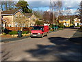
2
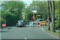
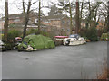
Roadworks in Fleet suburb
Snapped this whilst waiting at yet more roadworks
Image: © Colin Haywood-Gray
Taken: 4 May 2006
0.10 miles
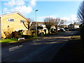
4
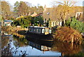
Larchfield Road houses
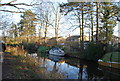
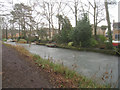
Basingstoke Canal, Fleet.
Image: © Fernweh
Taken: 6 Feb 2012
0.13 miles
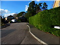
6
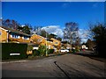
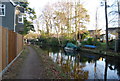
Looking along Larchfield Road from Folly Close
Image: © Shazz
Taken: 7 Mar 2014
0.13 miles