IMAGES TAKEN NEAR TO
Silvester Way, FLEET, GU52 0TP
Introduction
This page details the photographs taken nearby to Silvester Way, GU52 0TP by members of the Geograph project.
The Geograph project started in 2005 with the aim of publishing, organising and preserving representative images for every square kilometre of Great Britain, Ireland and the Isle of Man.

There are currently over 7.5m images from over14,400 individuals and you can help contribute to the project by visiting https://www.geograph.org.uk
Image Map
Images are licensed for reuse under creativecommons.org/licenses/by-sa/2.0
Notes
- Clicking on the map will re-center to the selected point.
- The higher the marker number, the further away the image location is from the centre of the postcode.
Image Listing (41 Images Found)
Images are licensed for reuse under creativecommons.org/licenses/by-sa/2.0
Image
Details
Distance
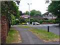
3
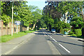
Gally Hill Road, Church Crookham
Towards Crookham Village.
Image: © Robin Webster
Taken: 18 Jul 2021
0.17 miles
4
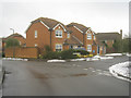
The Street, Church Crookham
Arterial road, east of Malthouse Bridge, leading into a modern residential sprawl.
Image: © Colin Smith
Taken: 8 May 2011
0.18 miles