IMAGES TAKEN NEAR TO
Victoria Hill Road, FLEET, GU51 4LQ
Introduction
This page details the photographs taken nearby to Victoria Hill Road, GU51 4LQ by members of the Geograph project.
The Geograph project started in 2005 with the aim of publishing, organising and preserving representative images for every square kilometre of Great Britain, Ireland and the Isle of Man.

There are currently over 7.5m images from over14,400 individuals and you can help contribute to the project by visiting https://www.geograph.org.uk
Image Map
Images are licensed for reuse under creativecommons.org/licenses/by-sa/2.0
Notes
- Clicking on the map will re-center to the selected point.
- The higher the marker number, the further away the image location is from the centre of the postcode.
Image Listing (41 Images Found)
Images are licensed for reuse under creativecommons.org/licenses/by-sa/2.0
Image
Details
Distance
4
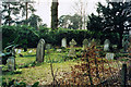
Hope Chapel Burial Ground, Fleet
Hope Chapel was demolished and only the burial ground remains.
Image: © Michael FORD
Taken: Unknown
0.05 miles
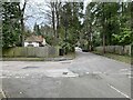
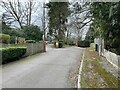
6
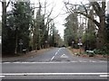
Entrance to Herbert Road
In an area known locally as 'The Blue Triangle'.
Image: © Stuart Shepherd
Taken: 28 Mar 2015
0.07 miles