IMAGES TAKEN NEAR TO
Westbury Gardens, FLEET, GU51 3HS
Introduction
This page details the photographs taken nearby to Westbury Gardens, GU51 3HS by members of the Geograph project.
The Geograph project started in 2005 with the aim of publishing, organising and preserving representative images for every square kilometre of Great Britain, Ireland and the Isle of Man.

There are currently over 7.5m images from over14,400 individuals and you can help contribute to the project by visiting https://www.geograph.org.uk
Image Map
Images are licensed for reuse under creativecommons.org/licenses/by-sa/2.0
Notes
- Clicking on the map will re-center to the selected point.
- The higher the marker number, the further away the image location is from the centre of the postcode.
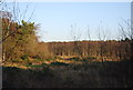
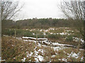
Image Listing (44 Images Found)
Images are licensed for reuse under creativecommons.org/licenses/by-sa/2.0
Image
Details
Distance
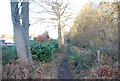
1
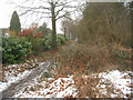
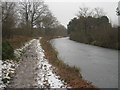
Footpath away from canal
The path skirts the Pondtail housing estate and eventually takes one to Fleet Pond.
Image: © Fernweh
Taken: 6 Feb 2012
0.12 miles
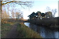
8
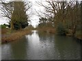
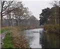
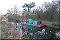
Basingstoke Canal: View from New Pondtail Bridge
This is the view looking east from under the New Pondtail Bridge.
Image: © Nigel Cox
Taken: 31 Jan 2016
0.16 miles